
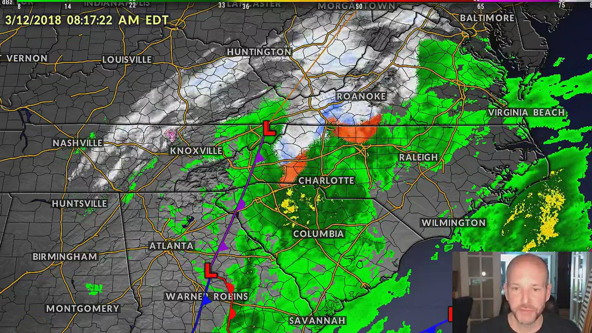
CHARLOTTE, N.C. -- Social media was buzzing all weekend over the possibility of snow in the Carolinas, especially in Charlotte.
Cold rain began falling Sunday evening across the Carolinas with a change to snow likely Monday afternoon. But before you decide to sprint toward the bread and milk aisles in the grocery store, take a look at the five things you'll need to know ahead of Monday's potential winter storms.
1. There will be snow
First Warn Storm Chief Meteorologist Brad Panovich said he has heard it all on social media.
“I’ve had people say nothing is going to happen and I’ve heard people say there is going to be a blizzard,” Panovich said. “The thing is, those two things are in the extremes."
"It’s going to be somewhere in between," he added.
Panovich said the winter weather is expected to not be a big deal to most of NBC Charlotte’s viewing area.
Viewers in the Charlotte area is expected to see traces to an inch of snow Monday afternoon.
2. Most of the snow will be in NC mountains, possibly in the foothills area
A winter storm warning was issued for Ashe, Avery and Watauga counties for all of Monday.
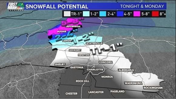
"For the mountains and the foothills and areas north, this could be a pretty significant storm," Panovich said.Those living in the mountains may see up to eight inches of snow and those in the foothills may see up to two inches.
Panovich gives Charlotte anywhere from a five to 20-percent chance of seeing two inches of snow through Tuesday morning. Those living north of the foothills has over 30-percent chance of seeing snow over two inches.
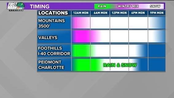
3. Snow timing
In the mountains and areas with an elevation of at least 3,500 feet, a wintry mix of snow is expected to arrive a little before 3 a.m. Monday morning. In the valleys, snow is expected to move in around 6 a.m.
Down in the foothills and the I-40 corridor, rain is expected to continue through 5 a.m. A wintry mix of snow is set to move into the area around 6 a.m.
Panovich said cold rain is expected to continue in the Piedmont and Charlotte areas through 6 to 7 a.m. A mix of rain and snow may move into both the areas a little before noon Monday.
4. Winter weather system is very hard to predict
Panovich said the chances of snow and possible winter storms battering the Carolinas depend on which direction the system travels to.
"I know there will be a heavy burst of snow somewhere in the Carolinas," Panovich said. "The question is, is it around Charlotte north? Is it over Greensboro? Is it over Raleigh?"
"That's what's hard to figure out," Panovich said. "It's like summertime thunderstorm forecasting. I know the ingredients are there for scattered severe storms. You just never know where the actual scattered storms pop up until you actually see the cloud development or you see it on radar."
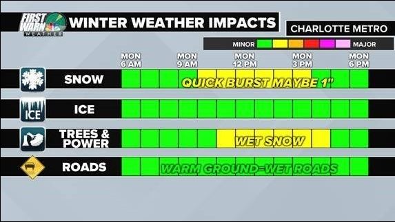
While Panovich feels confident about the timing of the rain and snow, he said the mix of "snow vs. rain" and the storm track will be difficult to predict several hours in advance. Panovich added that he feels a medium level of confidence in predicting the cold air moving into the Carolinas.
Panovich said he's confident that there will be five to eight inches of snow in the N.C. mountains.
5. Return of spring temperatures
Warmer, spring-like temperatures are expected to make a return near the end of the week. By Thursday, temperatures are expected to warm up to the 60s and may reach highs in the upper 60s on Friday.