
CHARLOTTE, N.C. — When severe weather hits the Carolinas, you might hear meteorologists talk about something called a "bow echo."
They get their name because on radar, they look like an archery bow. But they don't just look different, these storms can produce dangerous winds that stretch for miles. In this edition of Weather IQ, WCNC Charlotte will explain what causes a bow echo and their impact on severe weather.
Bow echoes
When it’s hot and humid, storms can develop. Those storms can then turn into multiple storms and in turn, those storms become a bow echo.
A bow echo is a quick-moving, bow-shaped line of thunderstorms that can produce swaths of damaging straight-line winds and even small tornadoes. Most of the time, bow echoes form clusters of thunderstorms.
Here's how it happens.
How they form
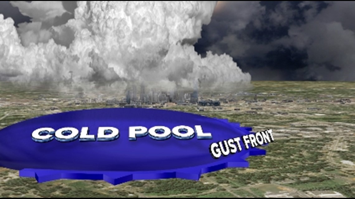
Rain-cooled air plummets to Earth's surface and spreads out. This cooler dense air or “cold pool” hugs the surface and forms a mini cold front called a gust front.

For the latest weather alerts, download the WCNC Charlotte mobile app and enable push notifications.
This front will drive up the heat and humidity of the day, forming new thunderstorms. As this process repeats itself, a strong inflow comes from the back, tilting the storm and causing the gust front to drive forward thus forming the bow.

They can also develop from squall lines or supercell thunderstorms. Here is the breakdown of what causes a bow echo.
- 46% - Clusters of thunderstorms
- 30% - Squall Line
- 24% - Supercell
When bow echoes or a series of them travel over 250 miles causing widespread severe wind gusts, then a bow echo is classified as a derecho.
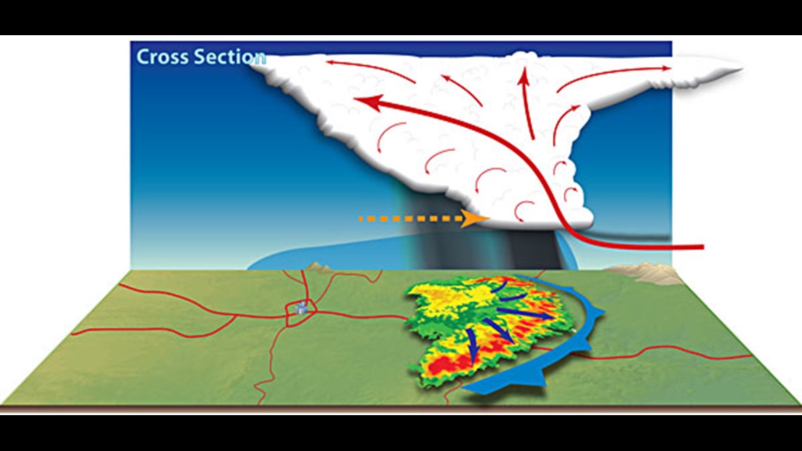
Bow echoes fall under the term QLCS, or quasi-linear convective systems.
A QLCS can form kinks in the line of storms that cause rotation. The northern part of a bow echo is most notorious for developing quick spin-up tornadoes, something that we see a lot of in the Carolinas.
So whenever you see storms on the radar bowing, it should get your attention and you know it is time to be Weather Aware.
WCNC Charlotte’s Weather IQ YouTube channel gives detailed explainers from the WCNC Charlotte meteorologists to help you learn and understand weather, climate and science. Watch previous stories where you can raise your Weather IQ in the YouTube playlist below and subscribe to get updated when new videos are uploaded.
Contact Chris Mulcahy at cmulcahy@wcnc.com and follow him on Facebook, Twitter, Instagram and TikTok.