
CHARLOTTE, N.C. -- After a week of summer-like temperatures, heavy rain, and possible storms are on its way to Charlotte area.
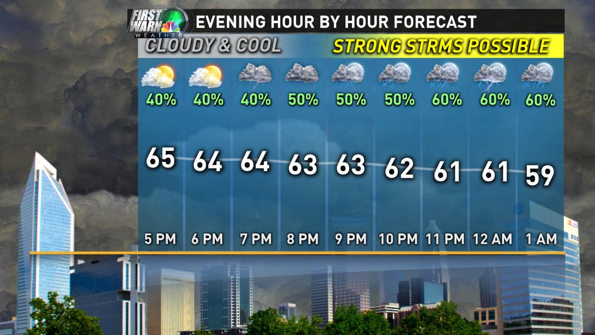
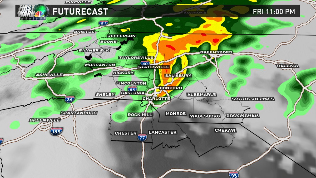
Meteorologist Sarah Fortner says rainfall in the area should start cranking up around 10 p.m. Friday.
"Moderate downpours, small hail and gusty storms are what we're looking for later tonight," Fortner says.
Duke Energy told Fortner that extra crews are on standby Friday night in case of power outages.
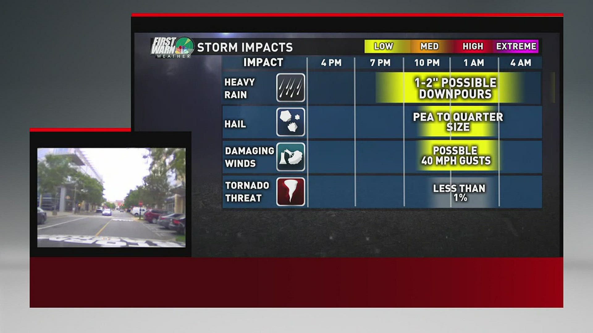
Flood watch was issued for Watauga County, according to NWS. Up in Ashe County, tornado warnings were issued on the other side of the Tennessee line over at Carter, Johnson and Sullivan counties.As for Charlotte area, Fortner says most of the downpour is expected late Friday night.
Update of the storms rolling through tonight: 6pm things will mostly still be west. Late night plans? Prepare for a downpour! pic.twitter.com/CKgxMClv3A
— Sarah Fortner (@SarahFortnerWx) May 12, 2017
She said the second half of Saturday and all of Sunday are expected to be sunny and dry.
Relax -- second half of your Saturday and all of your Sunday will be sunny/dry. #TGIF pic.twitter.com/lTcPhbglp4
— Sarah Fortner (@SarahFortnerWx) May 12, 2017