CHARLOTTE, N.C. — The numbers are still being crunched but we already know that losses from weather and climate disasters in the United States will exceed $10 billion across the United States in the 2019.
2019 is the fifth consecutive year in which 10 or more weather and climate disaster - each inflicting a billion dollars or more - has impacted the United States.
Nationwide, these events included 3 flooding events, 5 severe storm events, and 2 tropical cyclone events.
In the Carolinas, none was more prominent in 2019 than Hurricane Dorian.
Hurricane Dorian
After Puerto Rico, two years removed from Hurricane Maria, dodged most of the wrath of Dorian in September, the storm made its way to the Bahamas. As a Category 5 and later a 4, Dorian parked itself along the islands for more than a day -- barely moving with its incessant winds tearing buildings apart.
"This is unprecedented," said Jeff Masters, meteorology director at Weather Underground. "We've never had a Category 5 stall for so long in the Atlantic hurricane record."
RELATED: 'Hey, we found your Jeep on the beach': Owner did not know his SUV was stuck in Dorian waves
It was the convergence of a high-pressure system and low-pressure trough that were fighting it out.
After killing dozens of people and doing an estimated $3.4 billion in damage to the Bahamas, the storm made its way up the eastern seaboard, grazing the Carolina coast and hitting North Carolina's Outer Banks before moving into Canada.
The WCNC First Warn Storm Team and colleagues across the Carolinas tracked the storm as it impacted the Southeast coast.
September also marked the 30th anniversary of Hurricane Hugo.
Hugo was a Category 4 hurricane with wind speeds well over 130 mph when it hit Isle of Palms, South Carolina in September of 1989.
Even the western Piedmont and foothills of North Carolina felt Hugo's wrath hours after it made landfall.
Hugo's center passed over I-77 between Columbia and Charlotte around 5 a.m. on September 22, according to the National Weather Service. It wasn't until quick-moving Hugo finally crossed I-40 between Hickory and Morganton that it was downgraded to a tropical storm.
If you lived in the Charlotte area in September 1989, chances are you have a Hugo story.
Homes were dark, businesses shut down, and Charlotte was ground to a halt as the storm devastated the Carolinas.
In 2019, the World Meteorological Organization also retired the names Florence and Michael following the devastating 2018 storms.
Tornadoes
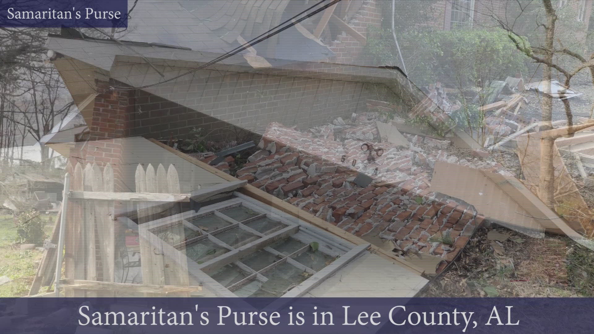
A powerful EF4 tornado with estimated maximum winds of 170 mph tore through Beauregard, Alabama on March 3. It killed 23 people, injured 90 more, and left a path of destruction spanning nearly 27 miles.
Volunteers from Boone-based Samaritan's Purse traveled to hard hit Lee County, Alabama to help. Edward Graham, son of Franklin Graham and grandson of Billy Graham, spoke to WCNC NBC Charlotte from the ravaged area.
“We got volunteers assessing and doing work orders for homes we need to go to, and the homes we already have work orders for we’re going through and re-tarping, putting tarps on the roofs where they’re damaged and removing trees off of the houses and off the driveways in order to get the homeowners back in there," he said.
Graham said chaplains from the Billy Graham Rapid Response Team were also in Lee County, helping first responders and homeowners being the healing process.
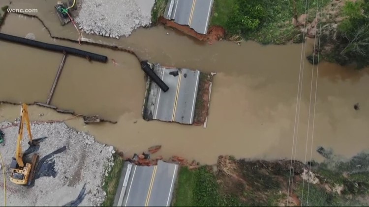
Weeks later, tornadoes hit closer to home with a multi-day outbreak across the Carolinas peaking on April 17.

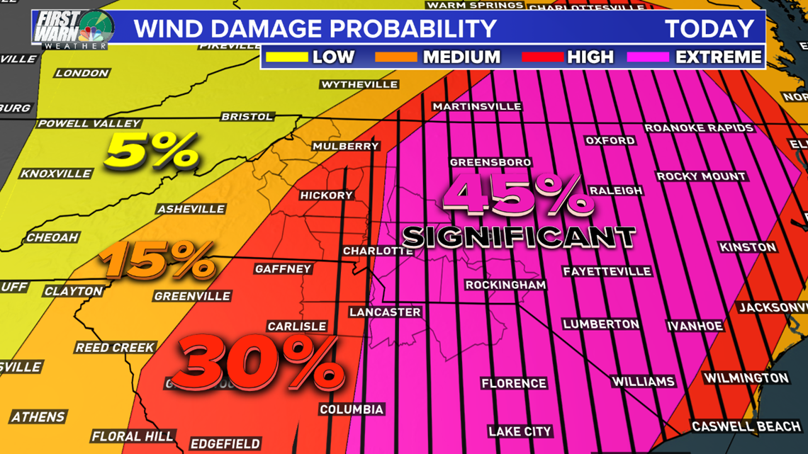
Thousands were without power across the Carolinas after multiple rounds of severe weather slammed the region.
Tornadoes were reported across North Carolina and South Carolina.
The National Weather Service collected over 200 verified storm reports across the Carolinas.
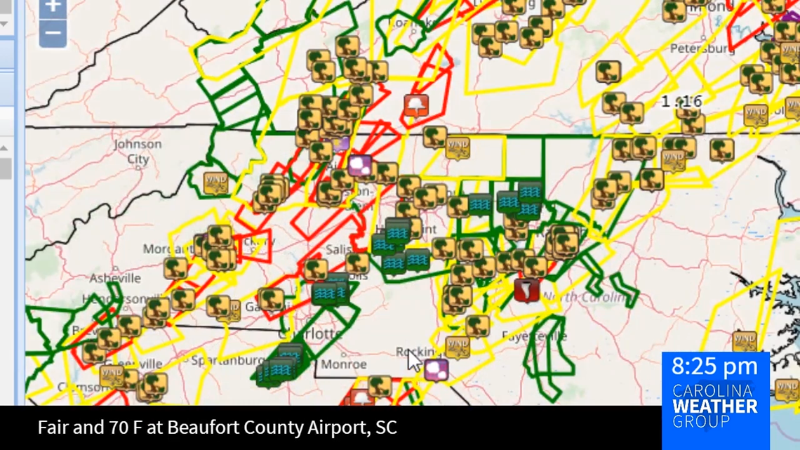
Storm damage included flooding in York and Cabarrus counties along with fallen trees across the mountains foothills. The below map shows the storm damage alongside initiated storm warnings for tornadoes, severe thunderstorms, and flash flooding.

Flooding

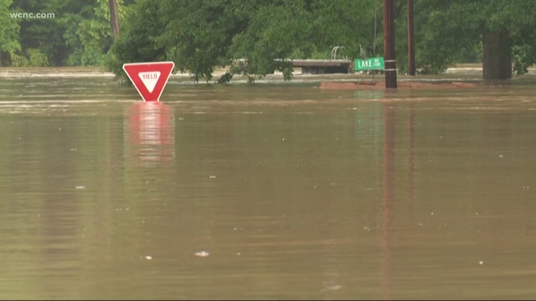
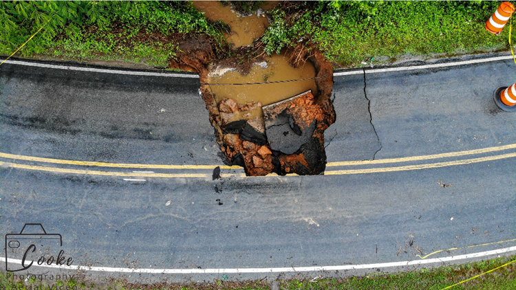
Flooding would return in June, when flash flooding closed schools in the western North Carolina mountains and foothills.
Over a foot of rain fell causing Mountain Island Lake to reach 106.7 feet, the second-highest level on record.
The Catawba River at Lookout Shoals Dam also set its 2nd highest crest on when it reached 108.19 feet. The standing record is nearly 80-years-old.
PHOTOS: Widespread flooding

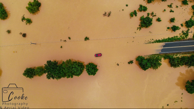
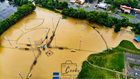

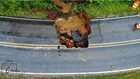
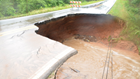

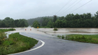

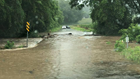


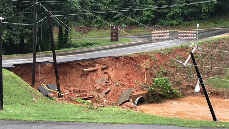
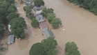
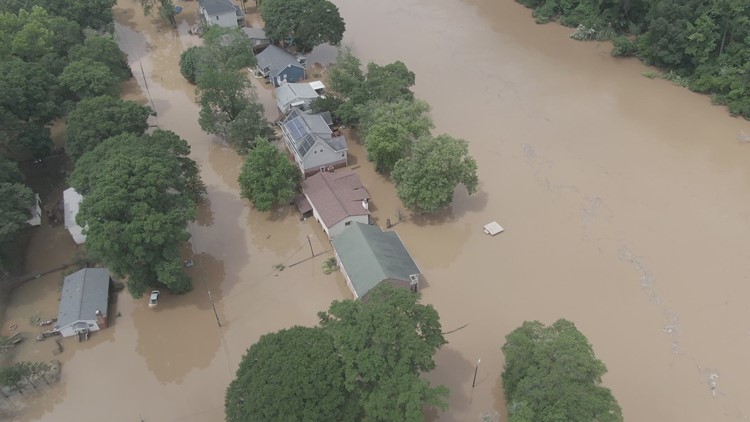
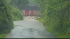


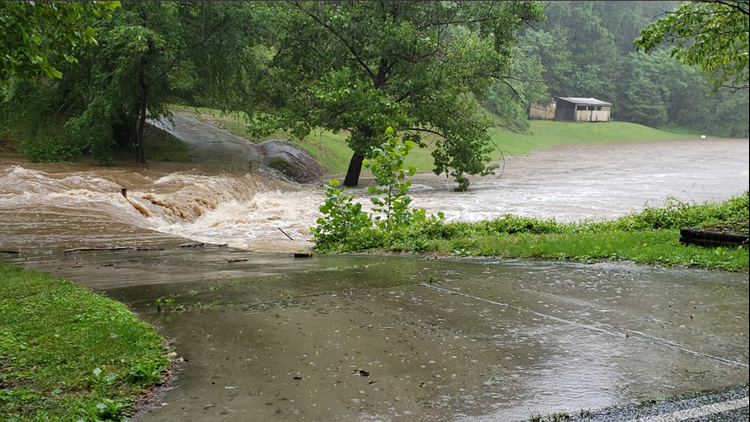
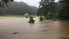
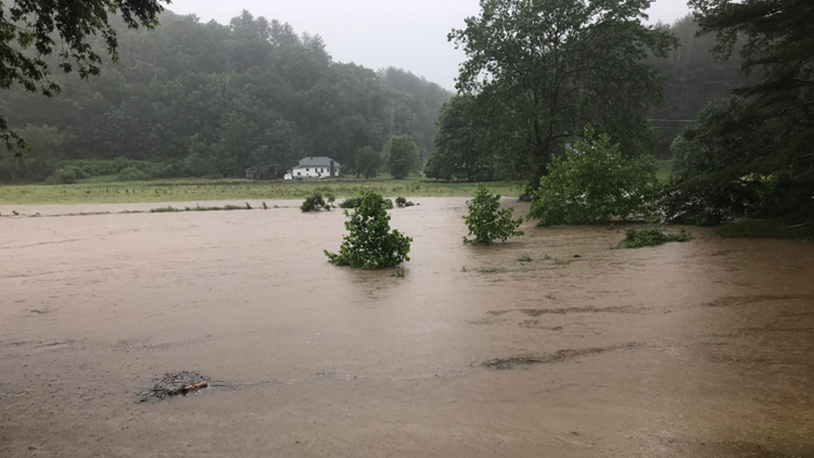

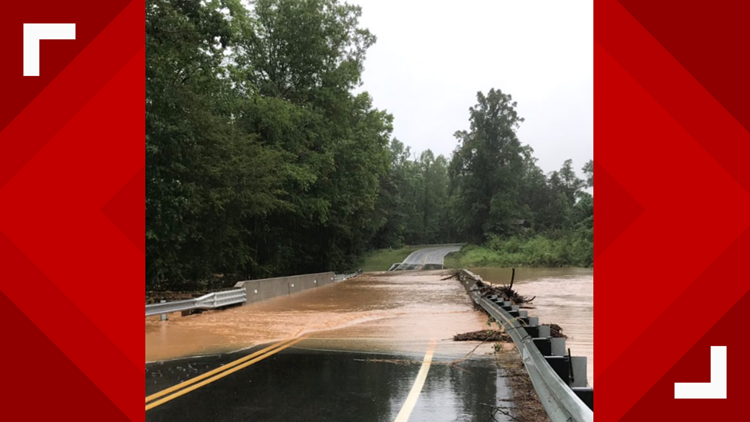

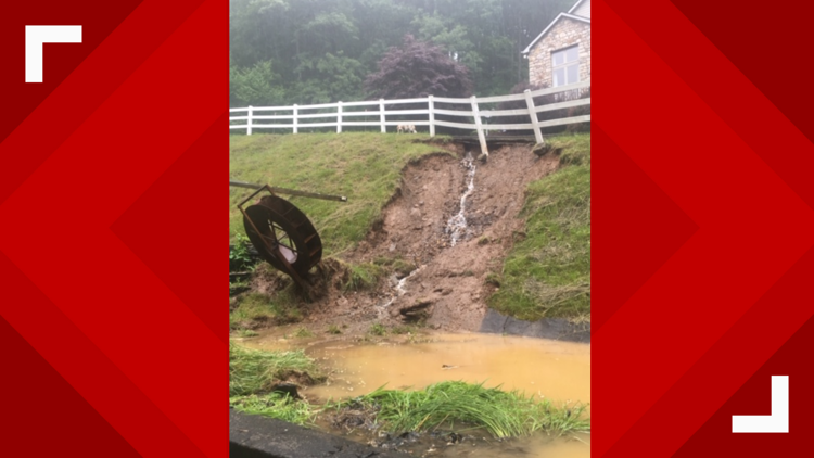

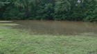
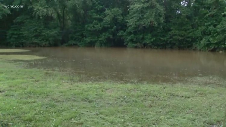
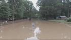
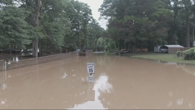

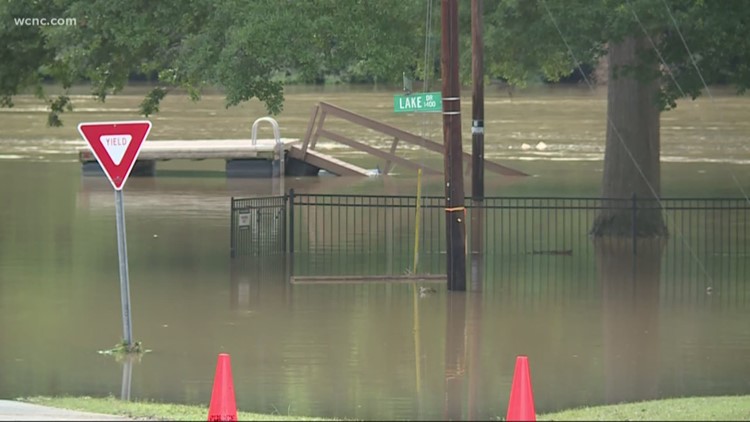
In some area, floodwaters were up to the tops of street signs and covered yards across the area. A shelter was opened for displaced residents.
The city of Hickory said the fire department performed at least 12 water rescues.
Record heat
July 2019 was Earth's hottest month in recorded history. The average planet-wide temperature in July was 1.71 degrees Fahrenheit warmer than the average of 56.9 degrees, according to the National Weather Service.
Temperatures in Charlotte hovered in the 90s with the heat index climbing into the triple digits.
And the heat was not isolated.
In October, we broke heat records as temperatures again returned into the 90s.
Trick-or-treat?
An ill-timed severe weather event sent trick-or-treaters running for cover on Halloween night across Charlotte and the Carolinas.
The quick moving squall line contained dangerous winds.
In other parts of the Carolinas, including near Greensboro, the system dropped tornadoes.
Charlotte's continued radar problems
July marked a sober anniversary in Charlotte's aviation history.
25 years ago, US Air Flight 1016 from Columbia crashed on approach to Charlotte Douglas International Airport.
Investigators found the crash was caused in part by a lack of local weather radar coverage in Charlotte.
The crash, which killed 37 and injured 20 others, helped to usher in an era of installing terminal Doppler radars at airports.
Today, the terminal Doppler radar located near Mountain Island Lake and covering the Charlotte metro, helps to fill some gaps left behind by full-power National Weather Service radars located over 90 miles away in Greenville-Spartanburg, Columbia, Raleigh, and Roanoke.
However the lesser-powered terminal Doppler radar does not replace the need for a full power WSR 88-D. That's why meteorologists, including WCNC First Warn Chief Meteorologist Brad Panovich, have been lobbying the National Weather Service and government to install a proper radar in Charlotte.
Their initial cooperative lead the National Weather Service to lower the beam height of those distant radars.
Now Panovich and others are working to create their own radar network in the Charlotte, triad, and foothills. He talked about the project on weather podcast, the Carolina Weather Group.
Snow
If you're hoping for snow not otherwise seen in Charlotte since the end of 2018, then Panovich says you may be in luck.
In his annual winter outlook, Panovich is calling for a warmer and wetter season - - but notes conditions could be right for one or two accumulating snow events.
"We will likely see a few winter storms that drive our seasonal snow above average but in between those few storms it will be warm and wet," Panovich explained." Being able to time out just a few storms with some cold air is all it will take. "