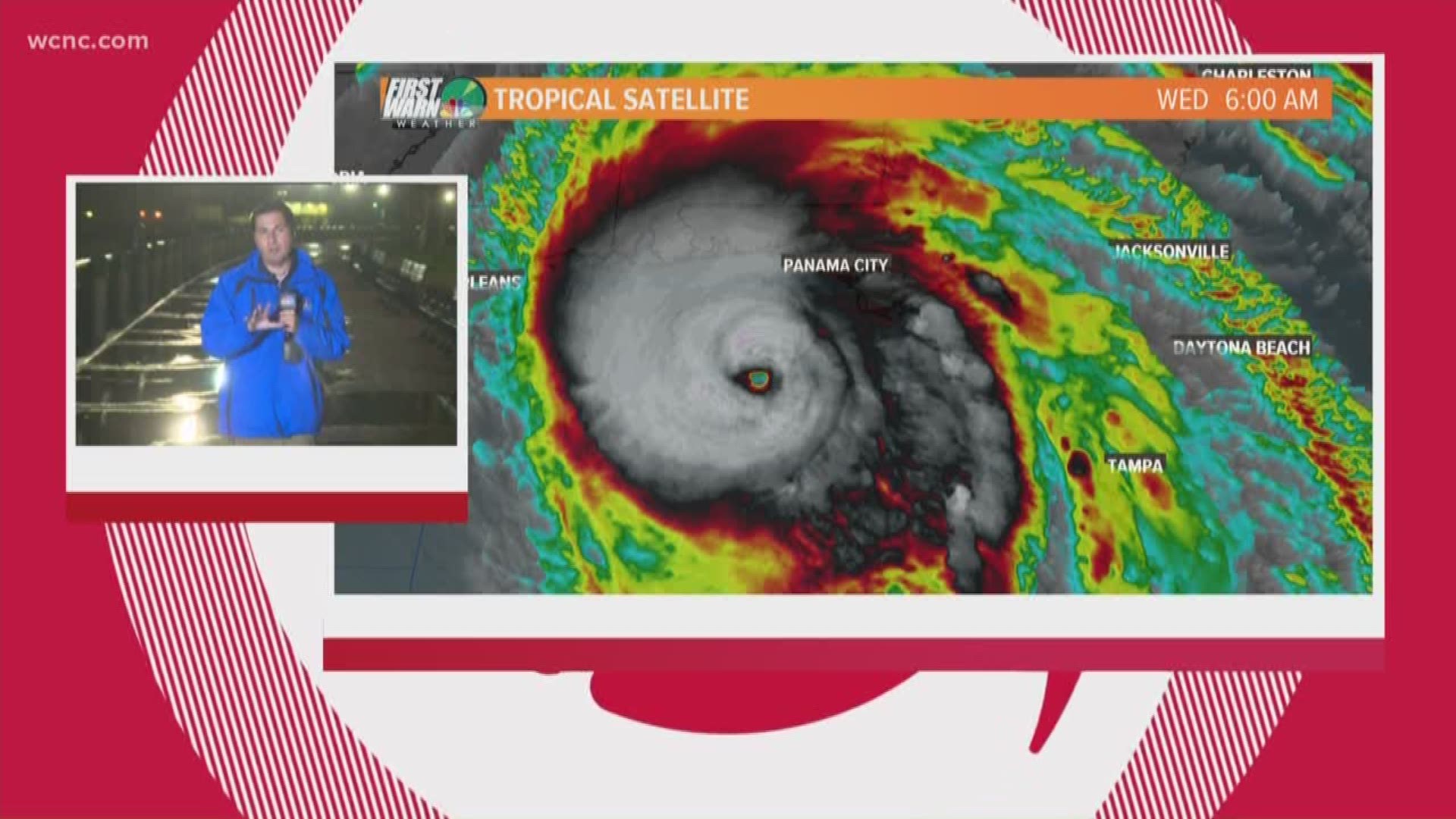
CHARLESTON, S.C. — As Hurricane Michael bears down on the panhandle of Florida, there are already tropical storm watches and warnings along the Carolina coast.
The powerful Category 4 hurricane is expected to make landfall near Panama City Beach, Florida with wind speeds of around 145 mph. Should the storm not lose any intensity, it would be the strongest in history to ever hit the panhandle of Florida.
Meanwhile, rain from an unrelated storm system started to drench Charleston, South Carolina and areas of the coast Wednesday morning. First Warn meteorologist Chris Mulcahy recorded wind gusts up to 30 mph and some areas with standing water of about an inch.
Once Michael arrives, those gusts could get up to around 50 mph with sustained winds coming in around 25-30 mph Thursday. A Tropical Storm warning is in place from Fernandina Beach, Florida all the way to Surf City, North Carolina. A Tropical Storm Watch is in effect from Surf City north to Duck, North Carolina.

Mulcahy said the Charleston area can expect anywhere from two to four inches of rain from Michael on top of any rainfall Wednesday. This could lead to flash flooding in low-lying areas throughout the day Thursday.