
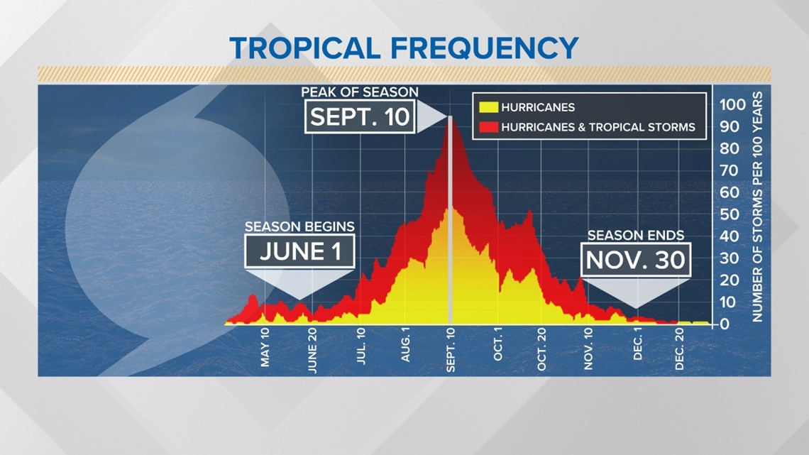
CHARLOTTE, N.C. — Historically, hurricane season peaks in September and slows down in October before ending in November.
There are currently two tropical waves in the Atlantic Ocean that could form into the season's next tropical threat, according to data published Monday by the National Hurricane Center.
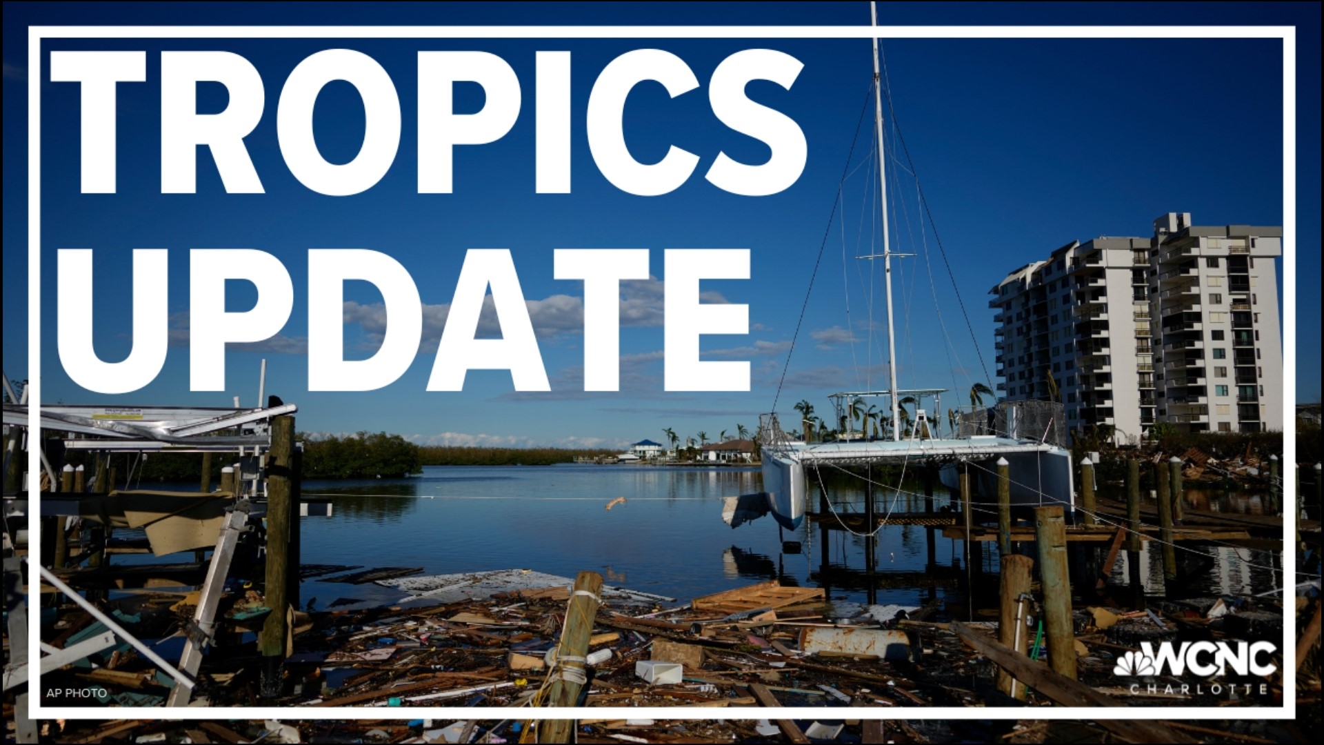
After a relatively quiet season so far this year, Ian made landfall in southwest Florida leaving behind widespread destruction. It was the second landfall of the storm after hitting Cuba just days earlier.
Ian would reemerged into the Atlantic Ocean before making a South Carolina, which produced storm surge in Myrtle Beach and along the Carolina coast.
While hurricane season is more than halfway over in Atlantic Basin, tropical threats continue to the end of the season on Nov. 30 and beyond.

Active activity in the tropics
Currently, there are two tropical waves in the Atlantic Basin. The two disturbances come on the heels of Ian’s late-September landfall.
The first of the two waves with the closest approach to land is several hundred miles east of the southern Windward Islands. This is known as Invest 91, a scientific name that proceeds classification as a "tropical depression," "tropical storm," or "hurricane."
The tropical wave starts with clusters of showers and storms. Moreover, the showers and storms are becoming better organized, which means some further development of the wave is possible.

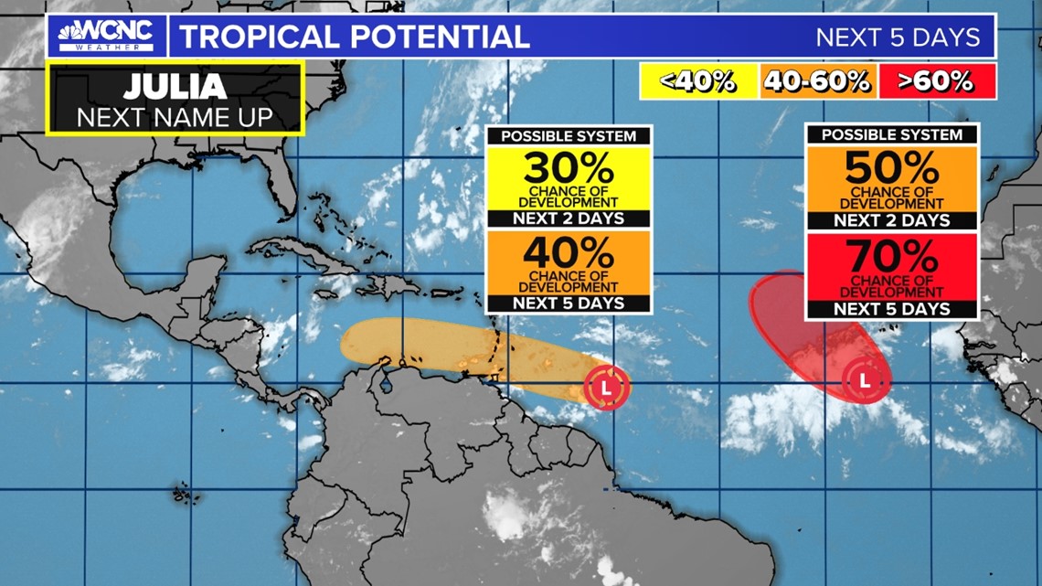
As the tropical wave approaches the Caribbean, atmospheric conditions are favorable for some growth. It could become the next tropical depression within the coming days.
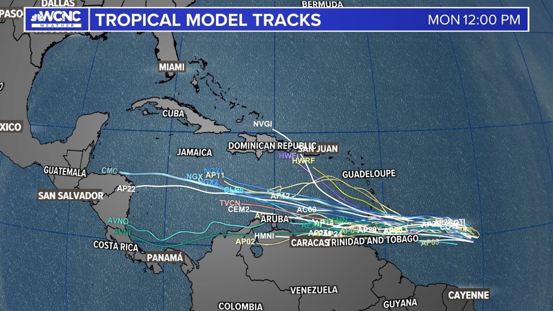
The tropical wave is moving towards the Windward Island at 15 to 20 mph. Long-rangeweather models are showing consensus the disturbance will move west towards the Gulf of Mexico.
The chance of formation is medium at 40% over the next five days.

The second tropical wave is just barely off the coast of Africa, which is some several hundred miles south-southwest of Cabo Verde Islands. The wave is currently disorganized with erratic rain showers and storm activity. It has a better chance of organizing over the next few days while moving through favorable conditions.
However, long-range weather data indicates upper-level winds could eventually disrupt its chances of formation. Nonetheless, the system doesn’t appear to have any threat to the United States as its forecast to lean northward into the eastern Atlantic.
It has a 70% chance of formation within the next five days.
The next name on the 2022 Atlantic Hurricane Season’s list is Julia.
Contact KJ Jacobs at kjacobs3@wcnc.com and follow him on Facebook, Twitter and Instagram.