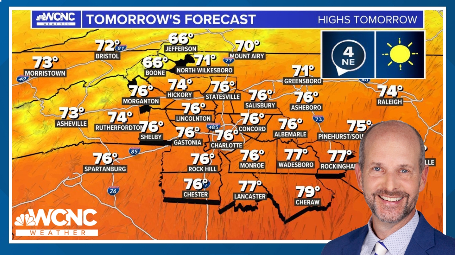
The last few weeks pop up and scattered thunderstorms have become a common weather headline in our WCNC forecasts.
Thunderstorms need an unstable airmass to grow and survive. The two things that start this process are heat and moisture. Charlotte typically has highs in the upper 80’s and dew points in the upper 60’s, which is a reasonable environment for convective storms (thunderstorms).
THE CUMULUS STAGE
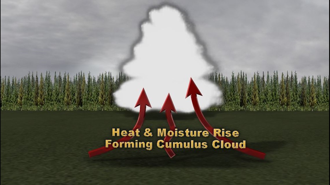
We often see a clear morning skies here in Charlotte turn into a partly cloudy to a partly sunny day due to the increase of cumulus clouds.
This is the first step of a thunderstorms development. This happens when the suns energy heats ground and surface air through the morning into the afternoon. Warm and moist air are lighter than cool and dry air, so they will start to rise.
This rising heat will form an updraft flowing moisture up into the atmosphere allowing it to cool and condense into these cotton-ball like cumulus clouds. On a fair day, these are referred to as “fair weather cumulus clouds” and nothing will grow from them further.
NOTE: For thunderstorms to form, there must be some sort of forcing to drive the warm and moist air up into the atmosphere. Fronts and lifting on the side of a mountain (orographic lifting) are 2 other examples of how thunderstorms can also form. When a warm and humid airmass has a “trigger” like a front, there is a better chance for more widespread thunderstorms and even more intense storms.
THE MATURE STAGE
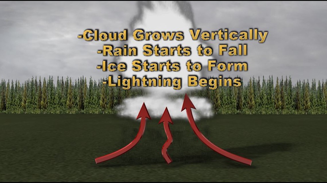
As long as the warm air (the fuel) below the cloud continues to rise, this cumulus cloud will continue to grow vertically. As more water droplets form the cloud will begin to darken and look more ominous.
Once the water is too heavy to be supported by this rising air, it starts to rain. If this cloud has grown tall enough, then it will support ice crystals that will start moving and colliding with one another.
This will eventually lead to thunder and lightning as the storm continues to intensify. The storm now has an up and down circulation which will support hail in the upper levels.
At this point this is now a cumulonimbus cloud, since it is producing rain.
FUN FACT: The nimbostratus and the cumulonimbus clouds, are the only clouds that produce rain. The prefix “nimbo” comes from Greek meaning rain.
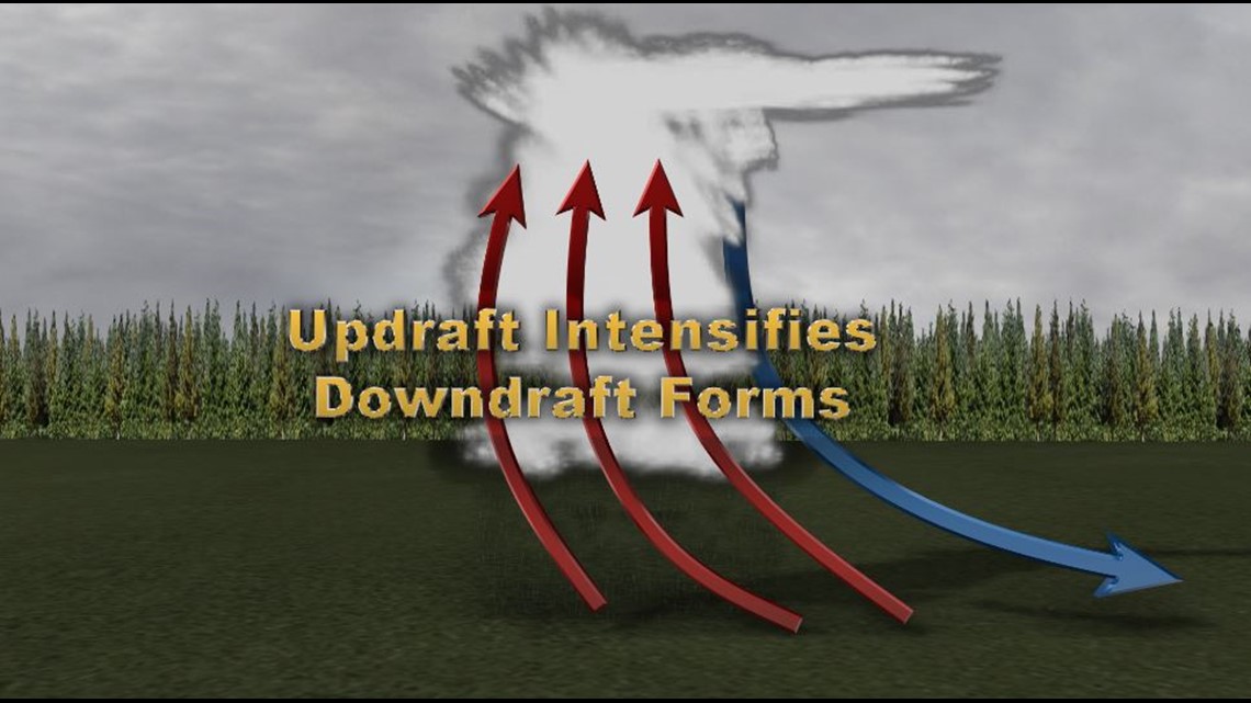
This falling rain will allow cool air to flow downward quickly and creates what is called the downdraft.
Downdrafts are where the gusty winds come from during a thunderstorm. The stronger the storm, the stronger the updrafts and downdrafts will be!
This is where there is a cause of concern. If the downdraft is producing wind gusts at or above 58 mph, then the storm is classified as severe!
A strong updraft will also be to blame for the support for hail. Storms that can produce hail the size of quarters or larger, are considered severe thunderstorms as well.
If the updraft is at 100 mph, then there is a good possibility that storm is supporting hailstones the size of baseballs or larger.
THE SUPERCELL
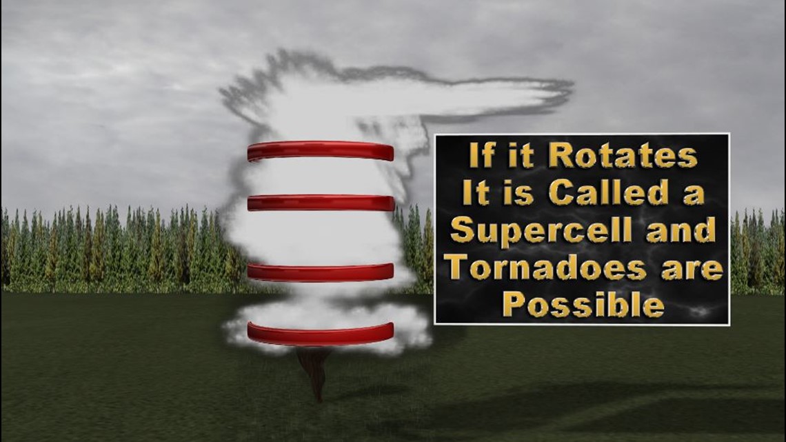
This is the worst-case scenario. A rotating storm. Shear is a term used by meteorologists and is a forecasting tool to judge thunderstorm strength potential.
Shear is either the change in wind speeds or direction with height. This change with height can cause a storm to rotate. When a storm begins to rotate is now called a “supercell.”
A supercell is a very strong thunderstorm that will often have a wall cloud. There is a 100 percent chance for large hail within a supercell and a 30 percent chance of a tornado!
If you ever see a rotating storm, you need to seek shelter immediately. If you are on the highway and can drive safely away in the opposite direction, make sure to do that as quickly as possible.
About 10 percent of all thunderstorms across the United States become severe with well less than one percent producing tornadoes.
General thunderstorm development will typically take an hour, but strong to severe thunderstorms, supercells and squall lines can last up to several hours.