CHARLOTTE, N.C. — A line of thunderstorms that spawned tornadoes in Texas, causing major damage in the Dallas metro area will move into the Carolinas Tuesday, creating the threat of severe weather.
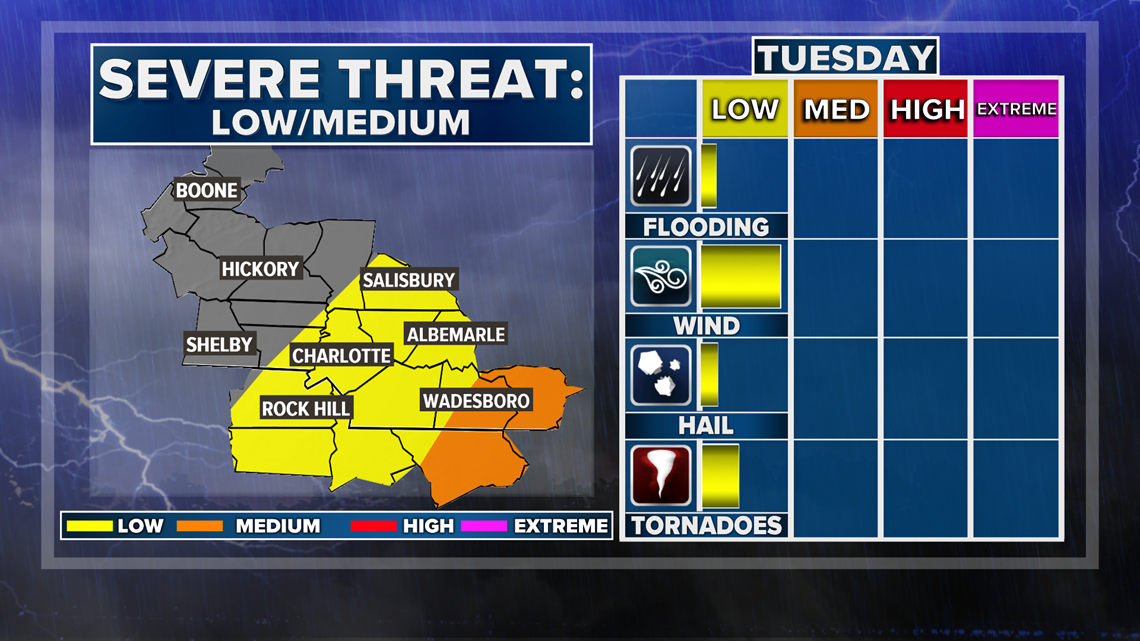
First Warn chief meteorologist Brad Panovich said the biggest threat will likely be east of I-77, including Union County and areas farther east.
"East of I-77, those areas have the best chance for seeing instability from the heating of the day," Panovich said. "Warm, humid air will build from the south and move in, setting the state for some potentially strong storms, maybe more toward I-95 in the afternoon."
Panovich believes the biggest threat in the Carolinas will be damaging winds but you can't rule out an isolated tornado.
"The main threat will be straight-line winds but I cannot rule out an isolated tornado threat towards the east," Panovich said.
Panovich described the threat as a non-zero, meaning it's small, but any time there's a risk of tornadoes you should be weather aware.
"I don't think it's a huge issue, but I could see east of I-77, enough vorticity — or spinning in the atmosphere — to help spin up an isolated tornado. It certainly looks like a distinct possibility," Panovich explained.
We could start to see rain moving into the mountains around 12 a.m. Tuesday with even the possibility of thunderstorms. The main front won't reach the Charlotte area until the early morning hours.
Showers and storms will move in around daybreak Tuesday, Panovich said, but the stronger storms will be closer to midday.
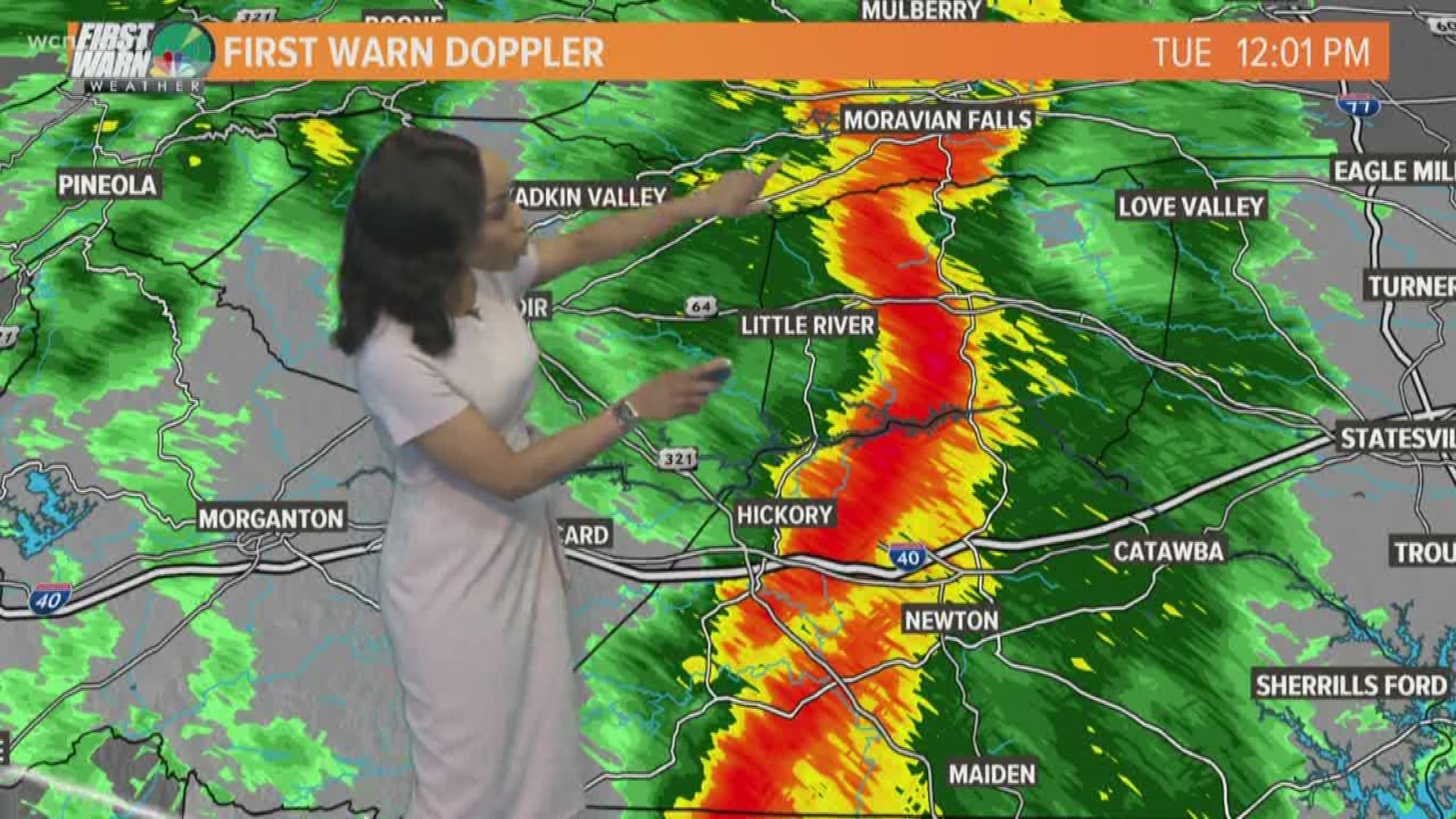
By 8 a.m. Tuesday, Panovich said showers and thunderstorms will blanket the Charlotte area, extending up to Winston-Salem. By 10 or 11 a.m., the threat of severe weather will reach from Salisbury south to the Midlands of South Carolina and areas east as the day goes on.
"About noon, the main front comes through Charlotte and it looks like a line will form," Panovich said. "It doesn't look real impressive but there could be a second line of storms."
RELATED: WCNC has a new app, download it here
That second line could bring strong storms to Union County. Overall, Panovich said the threat will be medium to the east and you will need to be aware of what's happening throughout the morning.
"For October, this is a decent little setup that we'll have to keep our eye on," Panovich said. "It's one of those severe weather kind of days. I'm just giving you a heads up, nothing too off the charts, but a day to be weather aware."
The cold front is moving very fast, Panovich said, so it will be completely east of the area by evening Tuesday as drier and cooler air moves in.