
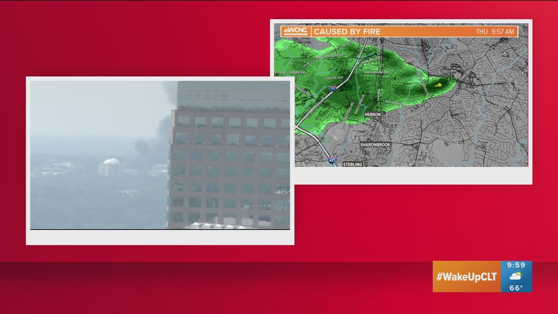
CHARLOTTE, N.C. — When a massive five-alarm fire started burning Thursday in Charlotte's South Park neighborhood, it sent smoke and particles into the air that were so dense that they could be seen on weather radar.
Showing in the same yellows and greens that precipitation is typically depicted as on radar, the smoke plume appeared like a storm would. However, what the radar was really seeing were the fine particles of burnt materials that had been lifted into the air by the 2,000-degree blaze.
Whether a certified meteorologist or an amateur weather-loving looking at a favorite smartphone app, the radar imagery would have shown the same thing.
While WCNC Charlotte meteorologist Chris Mulachy was using the television station's weather center to view the radar, Chief Meteorologist Brad Panovich was also able to tweet the imagery from a publically-available app.
The radar was a good way to see where the smoke plume was traveling.
The imagery showed how easterly winds were carrying the smoke westward toward Interstate 77 and the Starmount neighborhood.
How radars work
As WCNC Charlotte's Weather IQ series has explained, RADAR is an acronym for Radio Detection And Ranging.
RADAR sends out radio waves or pulses of energy from an antenna. These beams of energy eventually strike an object and reflect some of that energy directly back to the RADAR.
That object could be rain, snow, sleet, hail - or smoke particles.
The larger any one of these particulars the more energy it reflects back. Typically, this is how heavy is dedicated and then shown in red on a radar image.
The longer it takes that wave to return, the farther away the object is from the radar source.
For Charlotte, the nearest National Weather Service radar is in Greer, South Carolina, which is located near the cities of Greenville and Spartanburg.
As the radar beams travel from Greer to South Carolina, the curvature of the Earth drops the surface further and further away from the aerial beam. In turn, that makes the beam's measurement of the atmosphere higher and higher.
By the time the radar beam reaches Charlotte's South Park neighborhood, the beam is nearly 5,000 feet above the ground. With the smoke plume showing up on the radar Thursday, knowing this element helps us understand how tall the smoke plume was.
A lesser-grade radar operated by the FAA just north of Charlotte Douglas International Airport also gave a lower-atmosphere perspective of the fire.
Residents within miles of the fire in south Charlotte reported being able to see the smoke. Some residents even told WCNC Charlotte that ash and debris were falling at their homes despite being miles away from the fire.
A radar scans one beam every 1,000th of a second at the speed of light and continues to scan the area giving us an accurate picture of what is happening.
A typical radar will complete a full scan of the skies every four to six minutes, thus providing a fresh look at the movement of the smoke plume.
Continuing coverage of Charlotte's five-alarm fire
- The latest developments on the massive fire
- These are the victims of Charlotte's five-alarm fire
- Verify: Understanding what is a “five-alarm fire"
- Weather IQ: Why smoke and fire show up on weather radar
- See who owned the building that was under construction
- Charlotte's political leaders and witnesses share their stories