
CHARLOTTE, N.C. —
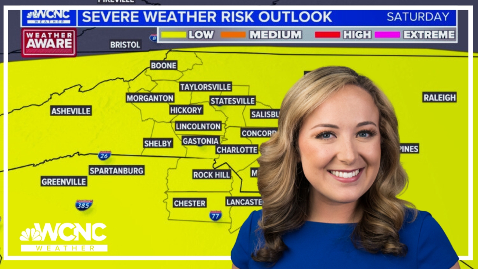
Saturday
Today will be mostly cloudy with scattered showers and storms. The severe weather criteria will be low but still present. The time to be weather aware is after 2 p.m. for the mountains and foothills and closer to 6 p.m. for the Charlotte metro.
Main threats are gusty winds 60+ mph, localized flooding due to heavy rain and recent rainfall, and small-to-medium sized hail. Watch for frequent lightning if you plan to be outdoors or attend any events. Make sure to check the storm policy before attending, too! Storm potential will taper off throughout the evening.
Sunday
Tomorrow will be another mostly cloudy day to start with a few showers and storms early. There is a notable drying trend for the afternoon hours which our team will watch closely. Eventually, more sunshine mixes in as highs are expected to reach the mid 70s.
Next Week
The first half of the week remains dry with highs only in the upper 70s and low 80s Monday and Tuesday. Eventually, a muggy and elevated storm pattern will return by mid-to-late week. It's still too early to know whether this trend continues through Memorial Day Weekend but at this point... all we can hope for is a better forecast than last year!
WCNC Charlotte’s Weather IQ YouTube channel gives detailed explainers from the WCNC Charlotte meteorologists to help you learn and understand weather, climate and science. Watch previous stories where you can raise your Weather IQ in the YouTube playlist below and subscribe to get updated when new videos are uploaded.
Stay connected to the WCNC Charlotte Weather Team:
Contact Brad Panovich at bpanovich@wcnc.com or follow him on Facebook, X and Instagram.
Contact Larry Sprinkle at lsprinkle@wcnc.com and follow him on Facebook, X and Instagram.
Contact Chris Mulcahy at cmulcahy@wcnc.com and follow him on Facebook, X, Instagram, and TikTok.
Contact Brittany Van Voorhees at bvanvoorhe@wcnc.com and follow her on Facebook, X and Instagram.
Contact KJ Jacobs at kjacobs3@wcnc.com and follow him on Facebook, X and Instagram.