
Strong storms moved through the Charlotte area Friday morning producing heavy rain, strong winds and hail. The First Warn Storm Team says more scattered storms are possible in the afternoon.
"You step outside today and it is overly muggy. That is prime time storm fuel," said meteorologist Chris Mulcahy.
The chance for spotty afternoon storms continues throughout the day.
A Flood Advisory is in effect for Chester, Gaston, Mecklenburg and York counties until 6 p.m. A Flash Flood Watch is in effect for Chesterfield and Lancaster counties until midnight. A Flood Warning is in effect for Chesterfield and Lancaster counties until Tuesday.
Strong storms capable of producing locally heavy rainfall could result in rapidly rising streams. Rainfall amounts of 2 to 4 inches is possible in a few areas. With saturated soils across the region due to heavy rain over the past few days there is potential for flash flooding through the afternoon and evening.
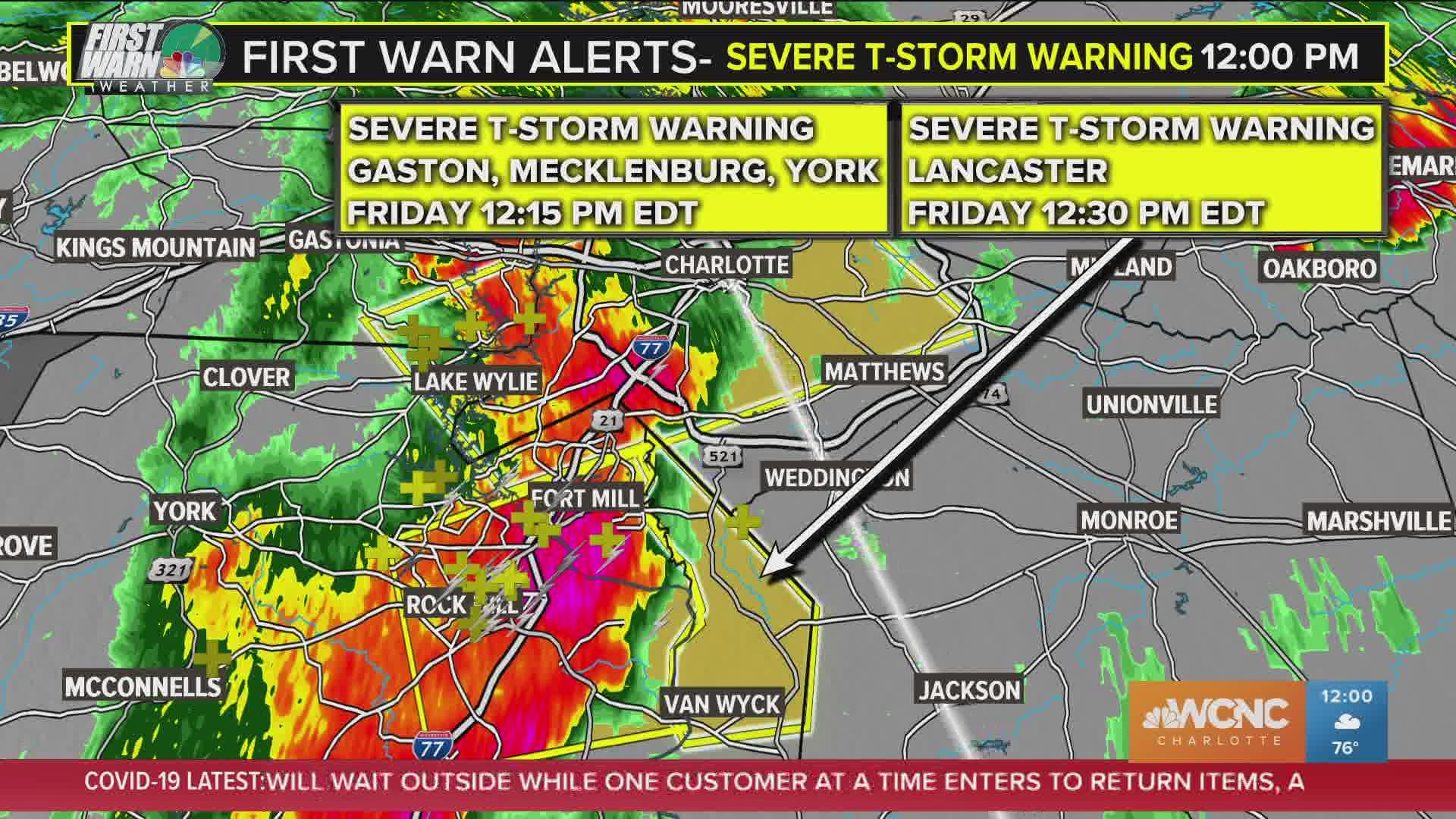
At 11:48 a.m. a severe thunderstorm was located 10 miles northwest of Indian Land, or near Carowinds, moving east at 20 mph. The storm brought heavy rain through the area and produced 60 mph wind gusts and quarter size hail.
Flooding of drainage ditches and low lying areas may occur, according to the National Weather Service. Small streams will rise rapidly. Do not drive through areas where water is flowing over the road.
Download the WCNC app for the latest weather watches and warnings.