CHARLOTTE, N.C. — An arctic cold front brought a heavy dose of winter weather to the Carolinas on Christmas Eve with snow and frigid temperatures across the region.
After a line of strong thunderstorms moved across the Carolinas earlier Thursday, rain turned to snow in the mountains with reports of heavy showers across the High Country. First Warn meteorologist Iisha Scott said there will be even more snow on Christmas Day, with up to 4 inches possible in some areas.
As for Charlotte, the rain went away but frigid air was rushed in by strong, gusty winds. Gusts up to 50 mph were reported in Charlotte and temperatures will drop below freezing overnight. The "feel like" temperature will be in the teens for most of the Charlotte metro, while the mountains will feel close to below zero on Christmas morning.
With a forecast high of just 35 degrees in Charlotte, the Queen City is looking at its coldest Christmas Day since 2004.
"It's not a long-lasting cold but it will be felt across most of the eastern U.S.," Chief Meteorologist Brad Panovich said. "Winds are really howling, too. The gusts behind system from the northwest are impressive."
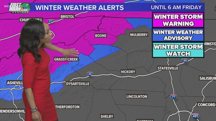
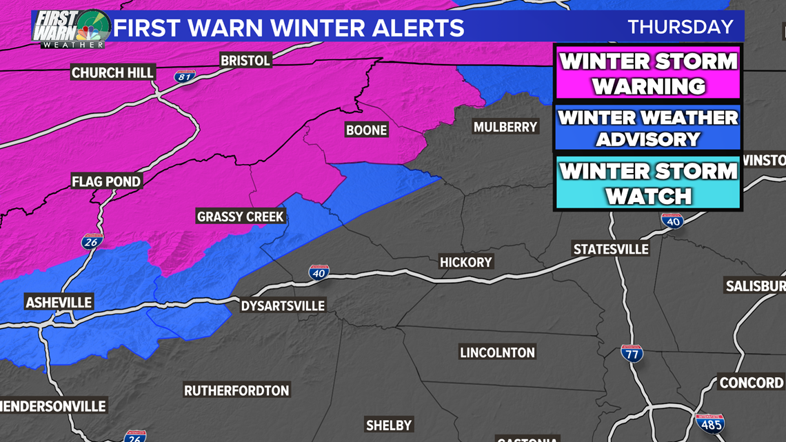
A Winter Storm Warning and Winter Weather Advisories are in effect for the North Carolina mountains, where up to 4 inches of snow is possible.
"We could actually see another one to two inches of snow as we work our way into Christmas Day," Scott said.
Those areas include Boone, Banner Elk and Blowing Rock.
To give you an idea of how cold this front is, temperatures ahead of it are in the 50s and 60s across North Carolina. Behind it, temperatures are in the teens and 20s. The high on Christmas Day will barely break freezing in the Piedmont with the mountains barely climbing into the teens.
"This is the real deal, this is a legit cold front," said Panovich.
Once the front moves through, a secondary surge will bring the possibility of snow flurries to the Charlotte area on Christmas Day. There won't be accumulations, but there's a shot we at least see some flurries for Christmas.
"It's very unlikely to be widespread, but as we go through Christmas afternoon, you could see occasional flurries across the Carolinas," Panovich said. "I don't think it's out of the question that we could see some snow flurries in Charlotte. No accumulation's expected but there could be some flurries and snow showers as the system pushes east."

For the latest First Warn forecast and weather alerts on your phone, download the WCNC Charlotte Mobile App.