

CHARLOTTE, N.C. — We have two tropical depression, and its a race to see which one will get the name Laura and which one will be called Marco. While both are on a collision course with the Gulf Of Mexico, they both might not survive.
Tropical Depression #13

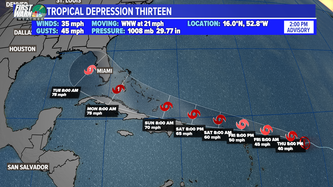
While this one is still far out it is moving fast and could pose a serious threat to Florida. This is also the one to watch for movement north and recurving earlier, which would put the Carolina at more of a direct impact. So don't let your guard down on this one at all. There is still time for this to change course and have a more direct impact here. The hurricane hunters are scheduled to check this one out later this evening.
Tropical Depression #14

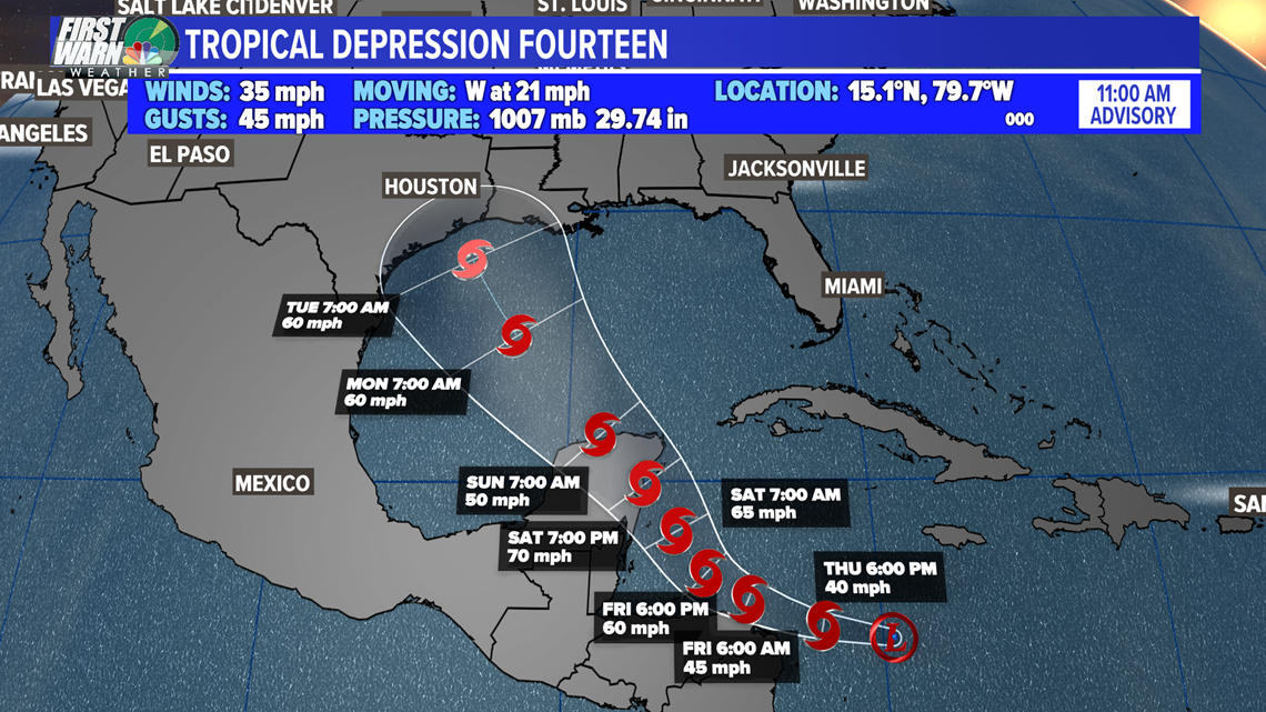
Tropical depression #14 could become a more intense storm as it crosses over some of the warmest water in the Atlantic. The water ahead of it is close to 90°, and as long as wind shear and land don't interfere too much, this storm could rapidly intensify before landfall. How strong 14 gets will eventually have an impact down the road on #13.
Names?
It's a race for which gets the name, Laura and Marco.
Could we have two storms in the Gulf?
While this could happen, there is also likely a higher chance it doesn't. This is rare and has only happened on a handful of occasions. Mainly because storm so close in proximity affect one another and usually weakness both. In some instances, one storm dominates and takes over and causes the other to fall apart. I think if we see #TD14 get going sooner, it could create sinking air and drying air ahead of #TD13 and cause it to weaken. Or we could see #TD13 veer north and avoid the Gulf altogether. This is why you need to stay weather aware for both of these systems. A lot can still happen.
Steering Currents:

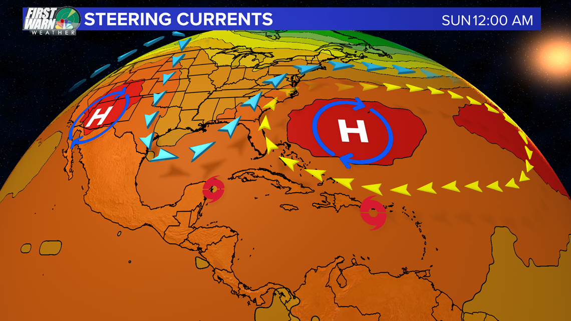
The high pressure over the Atlantic is steering #TD13, and the through or dip in the jetstream is steering #TD14. This is why they appear on a collision course right now. If the ridge weakens or doesn't move west with #TD13 we could see more direct impacts here in the Carolinas. We will know if things get hot and dry next week, that ridge is starting to move west.