
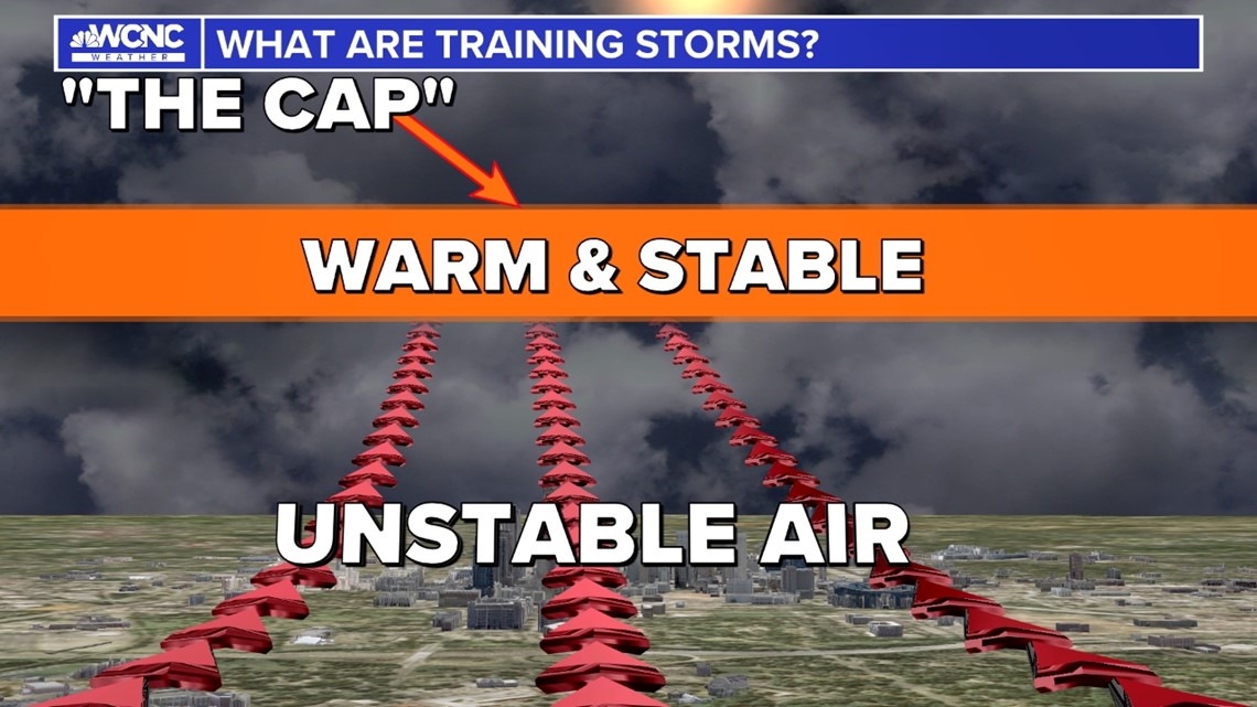
CHARLOTTE, N.C. — The CAP is a warm layer of dry air in the atmosphere that can range anywhere from just above to surface to 10,000 feet. Depending on how strong this layer is, the cap can prevent a single storm from forming even when the atmosphere is juiced up perfectly for storm development.
To understand the cap, let’s review the basics of storm development.
Thunderstorms form from rising, moist, warm air. That warm air will meet colder, drier air and will condense into clouds. Eventually, this process turns into a storm.
However, when a cap is in place, it acts as a ceiling and prevents the air from rising.

An example of this is a soda bottle. The bottle represents a super unstable atmosphere with elevated heat and humidity. But as long as that cap is tightly in place, even with everything building at the surface, it can’t expand upward. However, if the cap is removed, strong-to-severe storms can explode quickly.
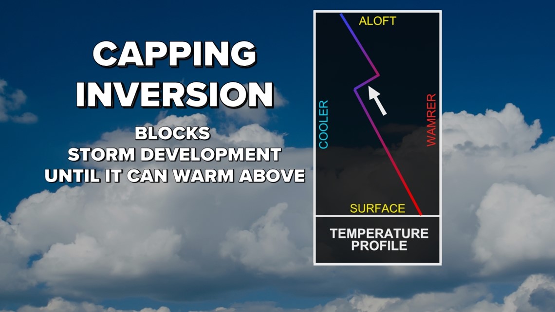
To overcome the cap, the temperature of the rising air must be greater than the temperature of the air it is trying to overcome. This mechanism is called an inversion.

This is why often during the summertime, storms develop only later in the afternoon; as the atmosphere spends the prior hours trying to break the cap.
The cap is notorious for busting forecasts. For example, a day forecast to contain severe storms can turn out to be a calm weather day if the cap unexpectedly remains in place. The deterioration of the cap can also adjust the expected timing of storms, with severe storms being able to form earlier or later than expected.
Technically, the cap is also called a temperature inversion.
You can visibly see that temperature inversion in what is called a temperature sounding, which is a line graph that plots data such as temperature and altitude. This data is typically collected from weather balloons.
Temperature inversions are common in the morning and evening hours.
These inversions can also be responsible for trapping widespread smells or smoke at the surface. This has occurred in Charlotte during gas leaks. It can also be observed after some fireworks shows.