

CHARLOTTE, N.C. —
Multi-Cell Clusters & Flash Flooding:
The title above simply means multiple storms that develop together. It can start as one storm develops and then matures. As it starts to dissipate, another one starts to form in its place. These storms can even eventually become numerous and merge together.
However, sometimes, one storm may form and then another will form in its wake. This process can continue multiple times pumping heavy rain over one location for an extended period of time. And if these storms are moving slowly (less than 15 mph), an extreme amount of rain can fall over a short period of time causing flash flooding.

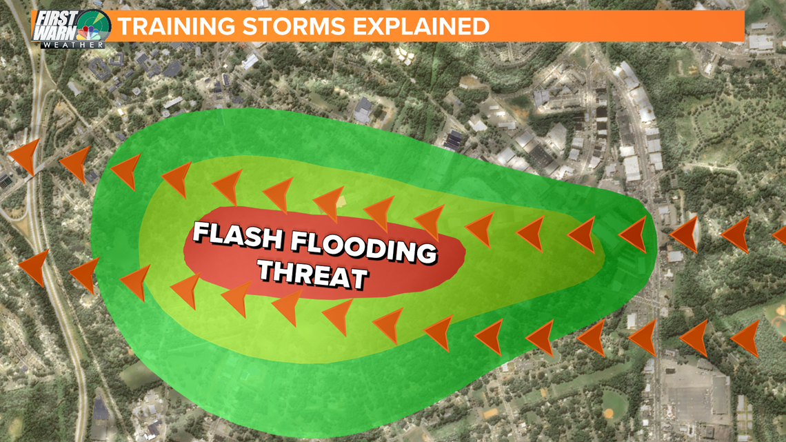
These types of storms are formally known as "back building" storms but when viewed on the radar, they are known as training echoes or training storms. Of course it is called this because each new storm is like a car on a train.
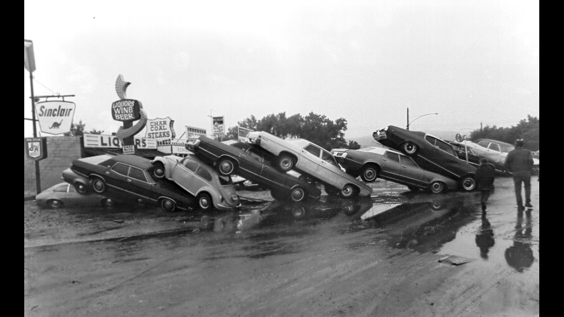
Example: According to the National Weather Service, in 1972, 15 inches of rain fell in six hours over parts of Rapid City, SD due to these training storms.

How "Back-building storms" or "Training Thunderstorms" Form:
It all starts with one storm. Every thunderstorm makes it cooler after it rains. But every thunderstorm also makes what is called an "Outflow Boundary" from its cold air that forms a cold pool. This outflow can form a gust front ahead of it and these are the winds you usually feel ahead or around a thunderstorm.
This outflow boundary will push outward and drive up the warm/hot moist air that we feel every summer. This will cause a new storm to form and this process can continue for a long period of time, as long as there is a steady prevailing wind that continues to drive one storm forward and another to follow in its path.
Where that first initial storm first dumped the heaviest rain is now completely saturated. So every heavy rain that passes immediately afterwards will cause more ponding and eventually flooding. The longer this type of pattern lasts, the more dangerous it can become.
For the atmosphere to have a set up like this you need:
- A juiced-up atmosphere that supports rain rates over 2 inches per hour
- Unidirectional winds (winds coming out of the same direction). A frontal boundary or a trough will amplify a threat like this often
Flash flooding is one of the most dangerous weather phenomena on earth. So on days, you hear, the Meteorologist say "training storms," know that some serious flooding could happen to some town, city, or neighborhood.