
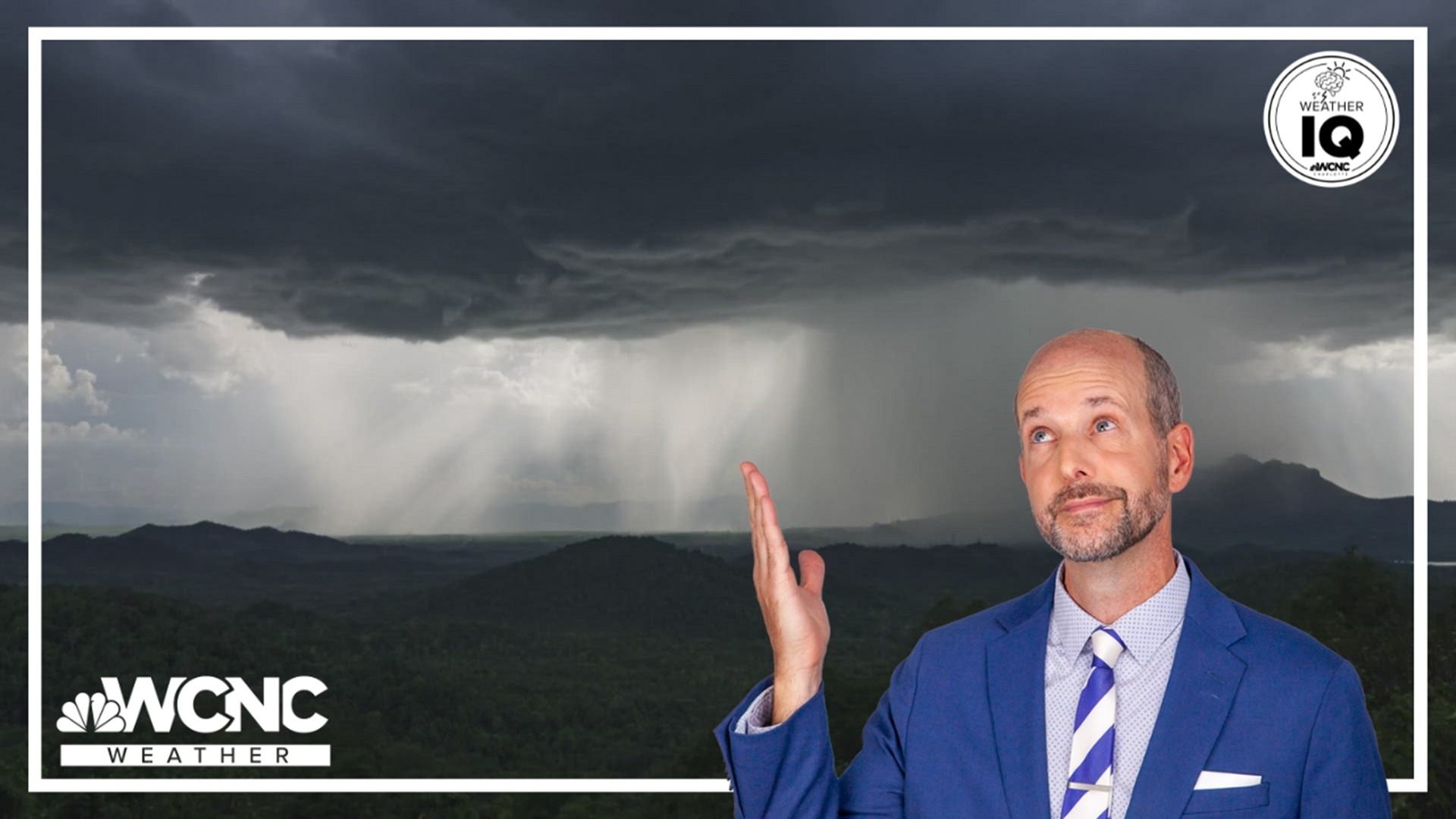
CHARLOTTE, N.C. — WCNC Charlotte is breaking down important weather terms to know to help keep you and your family safe.
Storm basics

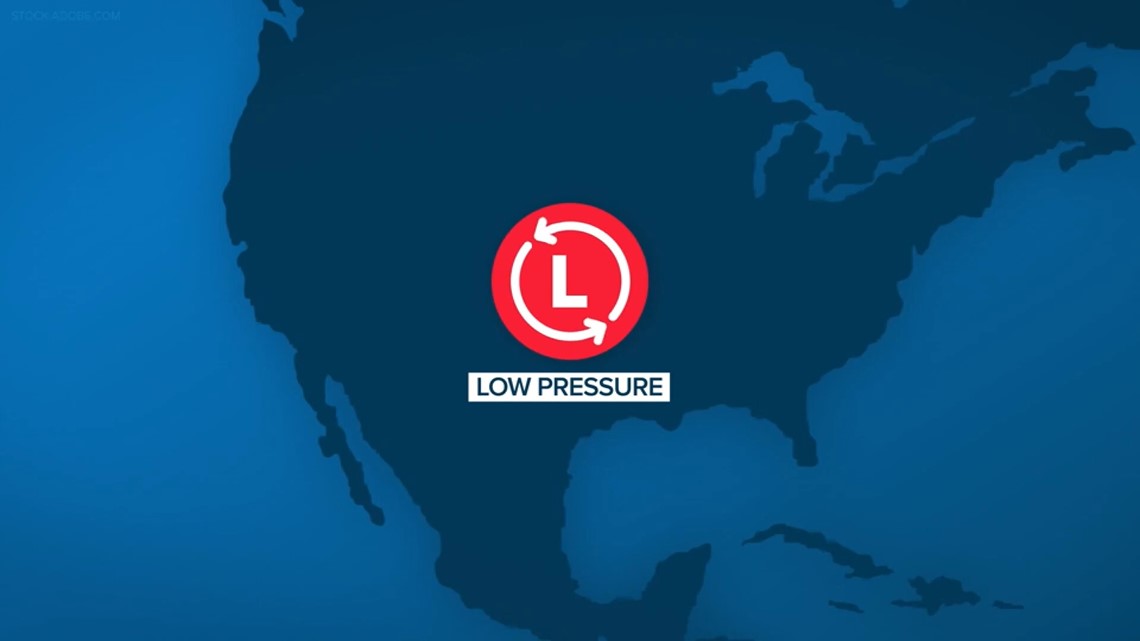
Mid-latitude cyclones
Many of the storms we experience in the Carolinas are known as mid-latitude cyclones.
Mid-latitude refers to where the United States lies on a map, while cyclone refers to an area of low pressure that rotates counterclockwise in the Northern Hemisphere.

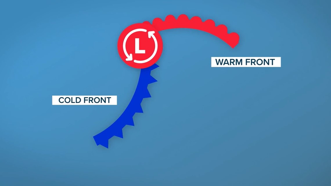
Mid-latitude cyclones drive most of the storm development in the continental U.S. -- most often involving a warm front from the south and a cold front from the north.
Cumulonimbus clouds


When a storm develops, the clouds we see are cumulonimbus clouds towering high in the sky. Commonly known as thunderstorm clouds, these are the only clouds that produce hail, thunder and lightning.
For the latest weather alerts, download the WCNC Charlotte mobile app and enable push notifications.
Nimbostratus clouds

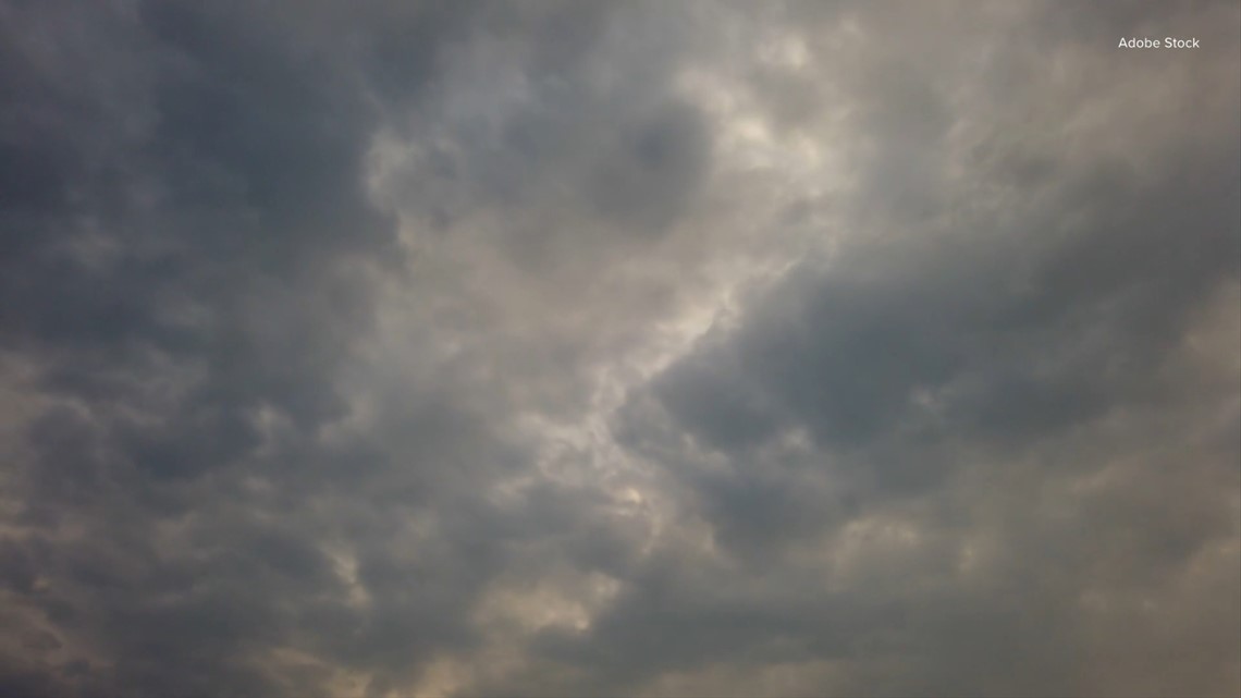
Rain clouds, or nimbostratus clouds, are dark, gray, and thick enough to block out the sun. These also form along mid-latitude cyclones and other frontal systems, but they produce persistent rain – no storms.
Shelf cloud


Ever felt the rush of cool air before a storm arrives? You’ve probably experienced a gust front along a shelf cloud. Shelf clouds are low, horizontal and wedge shaped.
These form along the leading edge of a storm where the shelf cloud is attached to the base. Shelf clouds look extremely ominous and if you see one, head inside.
Types of severe storms
The spring severe weather season in the South starts in April. To help you better understand the world around you, here is the second in our ongoing list of severe weather words you need to know to prepare:
Mesoscale convective system (MCS)


When a cluster of storms comes together and becomes more organized, it may become a mesoscale convective system. An MCS is much larger than an individual thunderstorm and normally persists for hours.
MCS is a term that encompasses derechos, QLCS storms, squall lines, and even tropical cyclones.
Derecho

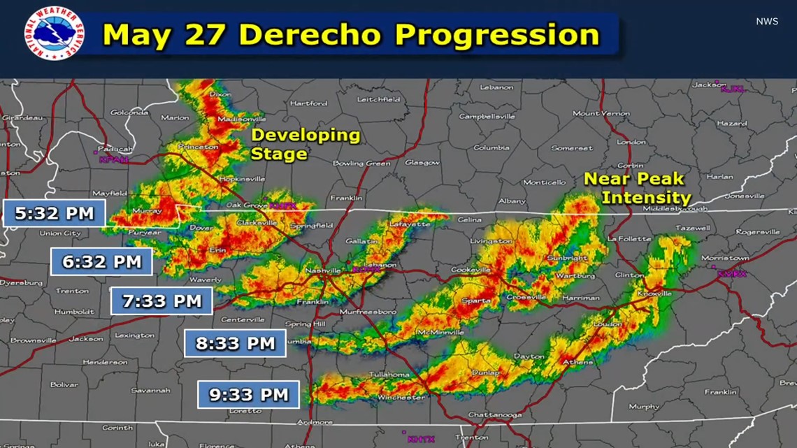
A derecho Is a widespread, fast-moving windstorm that causes heavy rain and downburst winds. These are long-lasting and can produce straight-line wind damage for hundreds of miles.
Quasi-linear convective system (QLCS)

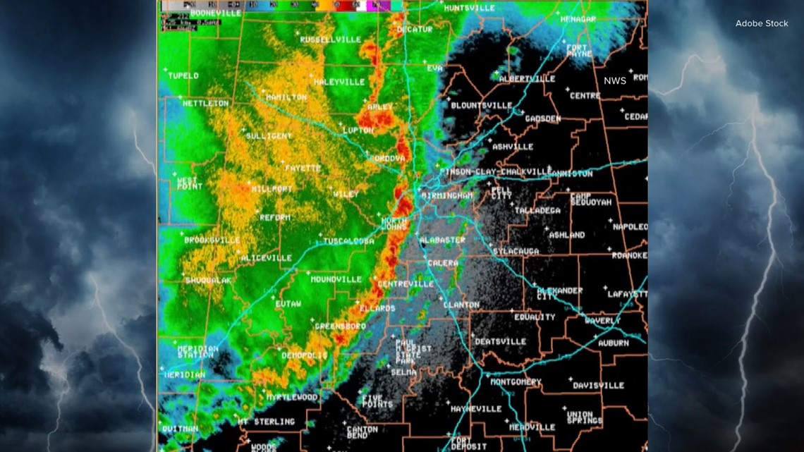
A QLCS is a sub-classification of a mesoscale convective system. These refer to a large, family of storms moving together in one line. The line will eventually cause the storm to bow out, where the line bends and breaks a part. These storms often cause quick, spin-up tornadoes in the Carolinas.
Bow echo

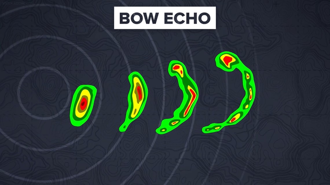
After a storm bows out, it creates a bow echo. Bow echoes are radar signatures that look like commas. Meteorologists watch these to determine straight-line wind potential and tornadic rotation.
Squall line


When the line of storms moves together, this is referring to a squall line.
In order for storms to become severe and produce significant damage, they need instability, lift, and moisture.
Instability Is defined as air parcels accelerating upward. The taller the storms grows; the more likely it is to become severe.
Wind shear Helps with the ‘lift’ aspect. This is the rate at which the wind speed and direction change.
Wind shear can help a storm tilt and move, stay active longer, and even aids in rotation.
Potential storm strength is measured in CAPE, which is an acronym for “convective available potential energy.” This refers to the amount of energy available for lift. In other words, this helps us understand the highest levels to which a storm could potentially rise.
When storms grow to severe levels, you may see more than just a classic thunderstorm cloud.
A wall cloud Is a rain-free piece that drops down from the main base of a cumulonimbus cloud.
Wall clouds range in size from a fraction of a mile to nearly five miles in diameter. The wall cloud is normally found on the south or southwest side of a thunderstorm.
Wall clouds can lead to funnel clouds and tornadoes, so they are monitored closely.
A funnel cloud Is condensation that extends from the base of a storm cloud. This rotating column of air does not come in contact with the ground.
But if it does reach the ground, we then call that funnel cloud a tornado.
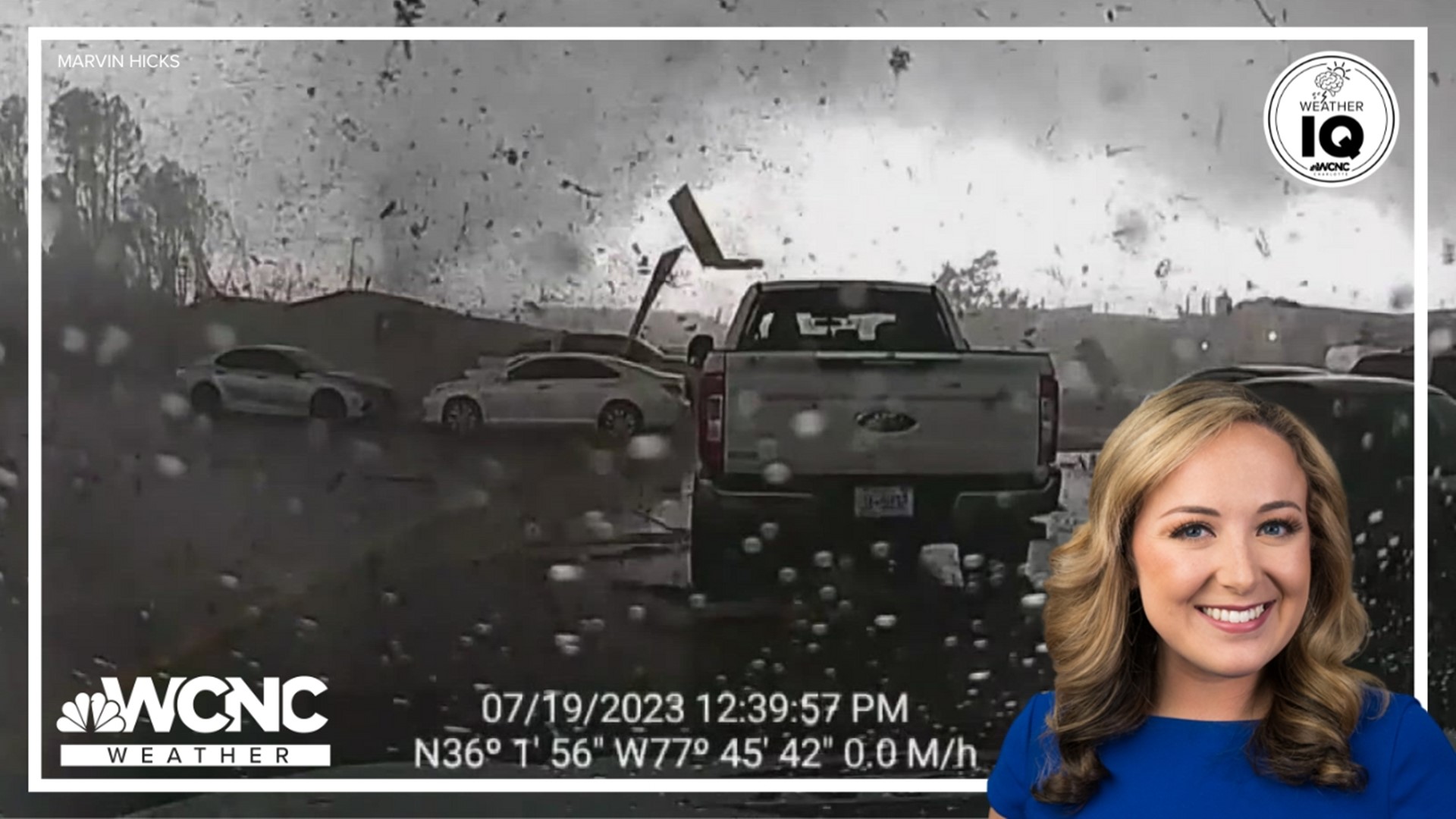
Tornadoes are violent, rotating columns of air that can cause widespread destruction. These are often accompanied by a loud roaring noise – similar to a freight train.
Contact Brittany Van Voorhees at bvanvoorhe@wcnc.com and follow her on Facebook, X and Instagram.
WCNC Charlotte’s Weather IQ YouTube channel gives detailed explainers from the WCNC Charlotte weather meteorologists to help you learn and understand weather, climate and science. Watch previous stories where you can raise your Weather IQ in the YouTube playlist below and subscribe to get updated when new videos are uploaded.