
CHARLOTTE, N.C. —
Forecasting Thunderstorms:
When forecasting storms, meteorologists use multiple models, parameters and indices to predict how severe the weather can be. One of the most important ones is called CAPE. And no, we are not talking about the ones that superheroes wear.
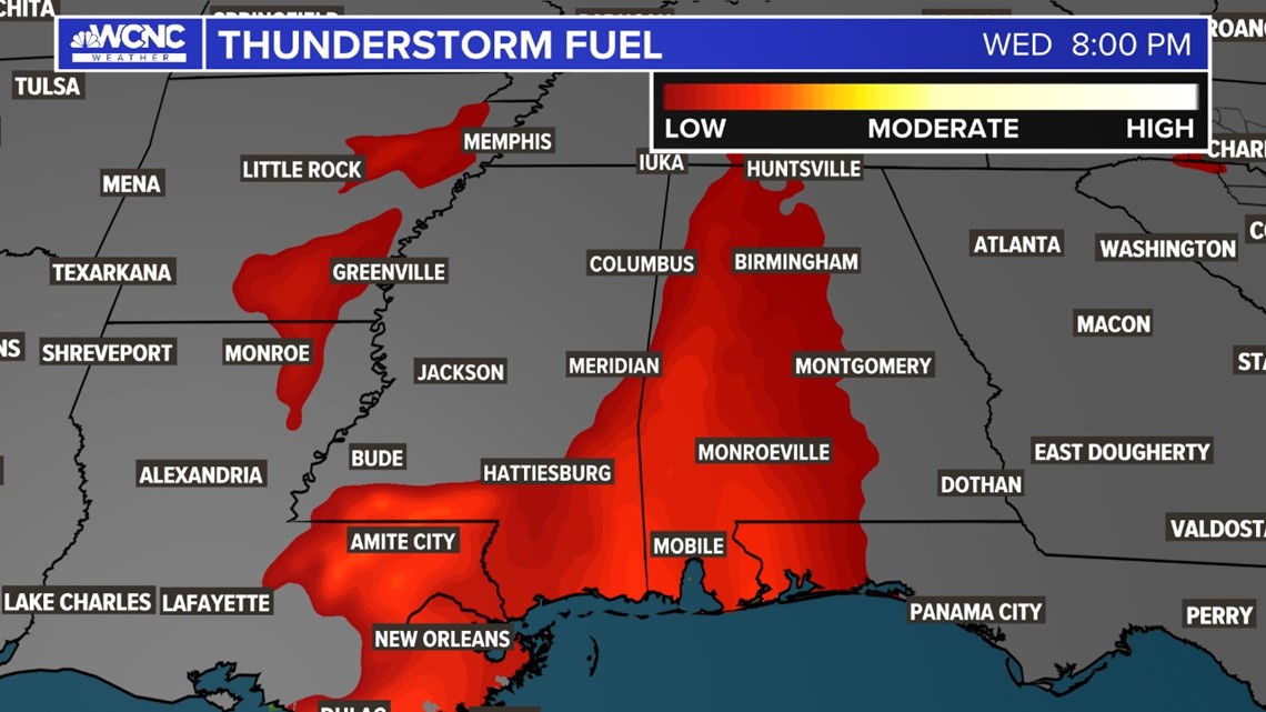
CAPE is an acronym for Convective Available Potential Energy. We simplify this by calling it "thunderstorm fuel." This index measures how unstable the atmosphere is. The more instability there is, the better chance we have for storms.
NOTE: Your WCNC Weather team uses this "thunderstorm fuel" graphic all the time to show you how unstable the atmosphere is. This simply is showing you the CAPE for the day.

Two main things drive an unstable atmosphere: Heat and humidity. The warmer it is and the more moisture the air holds, the faster that air can rise.
The Anatomy of a Thunderstorm:
The Updraft is the driving force of a storm. The hotter and more humid it is, it will increase the speed of this upward motion. This is what makes these thunderstorms, also known as cumulonimbus clouds, so tall. Thunderstorms form when that warm and humid air rises and condenses.

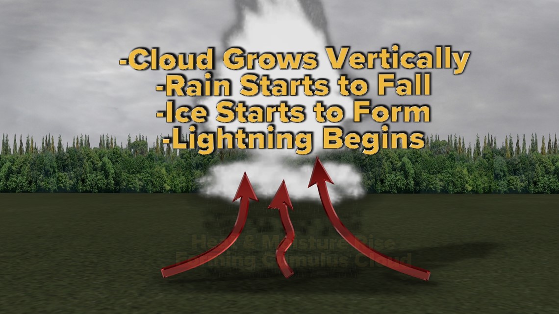
This forms a quick building vertical cloud that becomes increasingly unstable. Rain starts to fall, ice grows into hail on top of the storm and the storm literally gets charged up with lightning. The stronger the updraft is the more severe the impacts of a thunderstorm can be.
Making Sense of CAPE:
The higher the CAPE is, the quicker storms will grow. The quicker they grow, the stronger they can become. CAPE is a measurement of available energy so its units are in joules per kilogram.
When CAPE is 0-1000 J/kg this presents fairly weak instability. 1000-2500 J/kg is moderately unstable. At this point, strong to severe thunderstorms have become more likely. And when CAPE is over 2,500, the atmosphere is very unstable and these are the days that need to be watched the closest.

Higher values of CAPE can lead to:
- Better chances for large hail. (Above 2,500 can support the hail that will dent your car)
- Areas of torrential rains that are almost undrivable
- Intense winds and microbursts
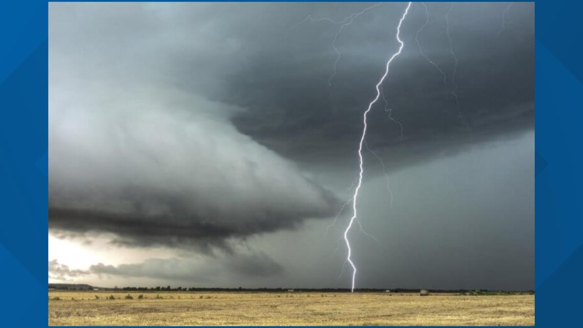
- Lightning will become more frequent as well!
- Tornadoes also need a very high C.A.P.E to form but their process also needs something called shear, which allows storms to rotate.
The Downfall of CAPE:
- Often times in the warm months, something called a "CAP" will prevent storms from forming. The area could have a highly unstable atmosphere but this "CAP" prevents storms from rising to their potential.
- CAPE rises and falls very rapidly. Thus many variables have to line up perfectly for severe weather to form.
This is only one tool of many used to forecast storm severity and potential, but it's one of the important ones. Severe weather needs multiple parameters to stack up at the right time or else the forecast can completely bust. This is what makes forecasting severe storms so difficult. But a high CAPE environment is the first factor in any severe weather forecast.
Contact Chris Mulcahy at cmulcahy@wcnc.com and follow him on Facebook, Twitter, Instagram, and TikTok.
Wake Up Charlotte To Go is a daily news and weather podcast you can listen to so you can start your day with the team at Wake Up Charlotte.
SUBSCRIBE: Apple Podcasts || Spotify || Stitcher || TuneIn || Google Podcasts
All of WCNC Charlotte's podcasts are free and available for both streaming and download. You can listen now on Android, iPhone, Amazon, and other internet-connected devices. Join us from North Carolina, South Carolina, or on the go anywhere.