
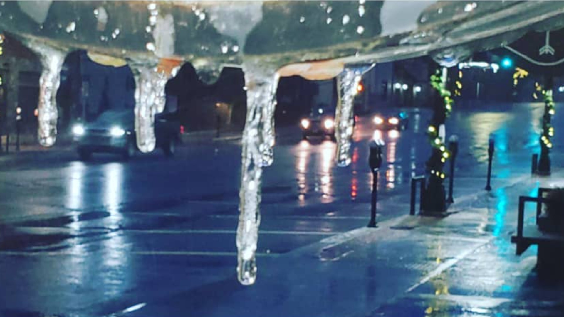
BOONE, N.C. — For the first time this season the western North Carolina mountains and foothills had accumulating ice to start off the day Wednesday. Freezing rain mixed with light sleet at times falling in the higher elevations creating a miserable slick start.
In Charlotte, the precipitation remained rain. The tiniest change in air temperature - brought on by location and elevation - was the difference between rain, freezing rain, and ice.
In the highest of mountain elevations, the roads and the sidewalks were being salted before the sun came up Wednesday. Those precautions limited the slickness on most of the major roads and walkways. Untreated surfaces like trees and vegetation remained prime candidates for ice coatings.


Precipitation falls thousands of feet through the atmosphere. Each layer of the atmosphere can independently have its own temperature. The more cold the precipitation encounters, the more frozen the precipitation at the surface.


In the mountains, an atmospheric process called "cold air damming" kept the layers of the atmosphere colder. That's where most of the ice fell. Even an inch or two of snow was possible near Boone and Blowing Rock.
Most of Charlotte saw rain because a high pressure system to our north kept things a tad warmer.

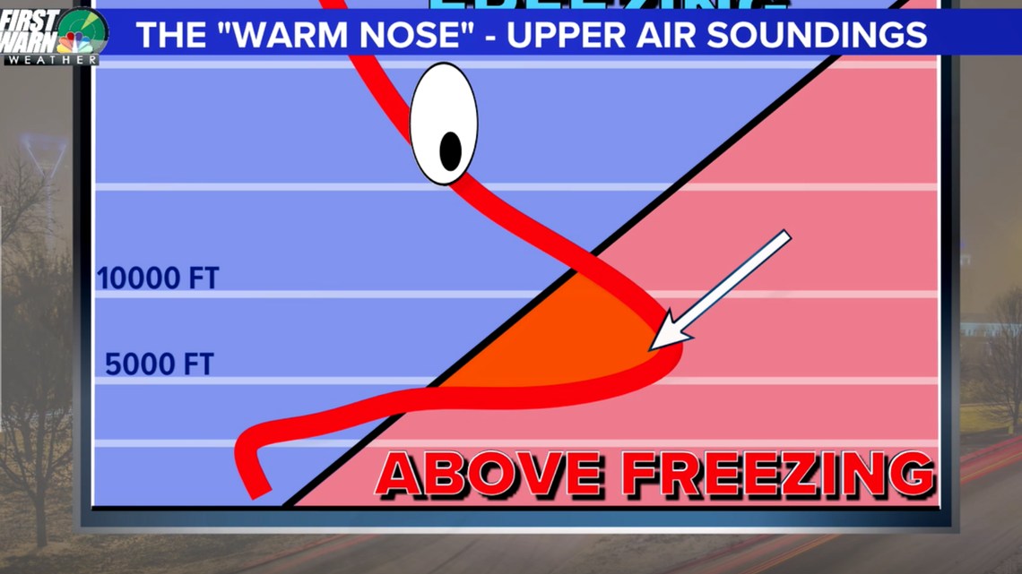
Those locations in-between those two extremes saw freezing rain, which is caused by what's called a "warm nose" layer nested between two and 10,000 feet in the atmosphere. This layer of warmer air melts falling snow into super-cooled droplets that freeze once they hit the below freezing surface. If the layer is shallower than 5,000 feet, the snowflakes often times only partially melt and then re-freeze as ice pellets before hitting the ground. This leaves behind an icy layer on the surface.
Sometimes the margin in the atmospheric layers are so small that the difference can be observed solely within a tall building, such as in uptown Charlotte.
On Wednesday, precipitation was not as heavy in the mountains for most of the morning. That benefit limited the amount of accumulating ice. Cars were still covered and the morning was far from nice but overall impacts were limited.
Final totals for the morning ranged from a few hundredths of an inch to around a tenth of an inch.
The only good news about freezing rain is that it is a limited process. When the rain freezes it releases warmer energy back into the air which eventually warms us back above freezing.