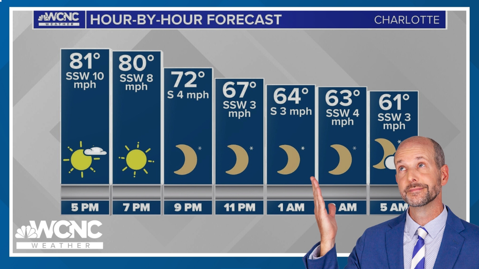
CHARLOTTE, N.C. — A few isolated thunderstorms remain possible Friday as a cold front pushes through the Carolinas. The cold front will usher in a sunny, and clear Fourth of July holiday weekend.
"There might be a little opportunity for a popup storm," WCNC Charlotte Chief Meteorologist Brad Panovich said regarding Friday's forecast. "I'm not going to totally write it off but the chances are going to decrease pretty quickly as we go through the evening."
Rainfall expected Friday evening was expected to be less than the rainfall seen in parts of North Carolina Thursday and Friday morning.
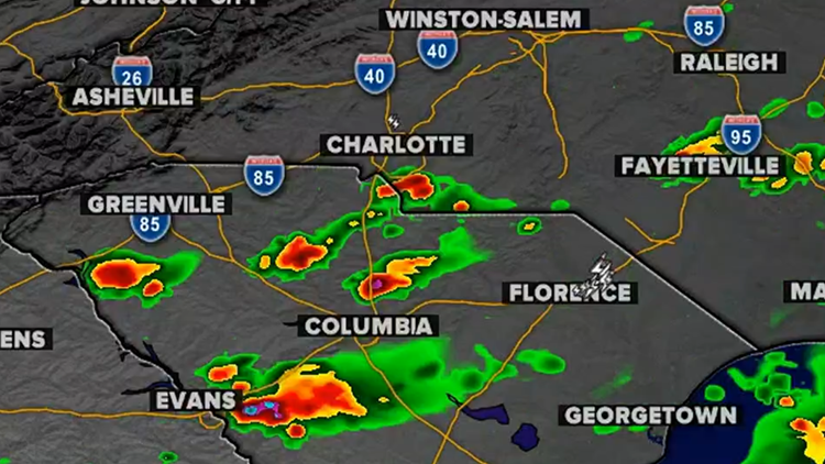
The biggest threat with any of these remaining discreet cells will be the possibility for localized flooding -- especially in low-lying areas with poor drainage.
Track storms with live radar:
By Saturday morning the front is out of the Carolinas entirely and continues moving eastward into the Atlantic Ocean. The transition ushers in a beautiful Fourth of July holiday weekend with sunny afternoons and clear nights. It also won't be nearly as humid this weekend before the muggy weather returns next week.
Tropical Storm Elsa formed strengthened into a hurricane on Friday morning, becoming the first hurricane in the 2021 Atlantic season. Elsa is the earliest "E" name storm on record in the Atlantic.
Elsa's center is moving near Barbados and is racing toward the west-northwest at 28 mph. Any impact to Florida, if at all, will be after the weekend toward Wednesday.