CHARLOTTE, N.C. — Editor's Note: New weather forecast model data that became available later Wednesday and into Thursday, have continued to shift the storm further east. As a result, Brad has updated his initial snowfall accumulations. He explains the factors changing the forecast in Thursday's update, which can be found here. For comparison, his original thoughts from Wednesday morning follow:
As the likelihood for a second winter storm in the Carolinas this week increases, WCNC Charlotte Chief Meteorologist Brad Panovich is out with his preliminary forecast on possible snow and ice totals.
Unlike the storm that brought the highest snow totals to the mountains of western North Carolina, this second storm has the potential to bring the highest snow totals to the piedmont of central North Carolina. Some ice and sleet could even work their way into the Carolinas coast.
For Charlotte, it could be another tough call between which hours it snows, and which hours it rains.
Possible Timing
Panovich said the current patterns and models are showing the potential for wintry weather mostly for Friday, with some potential the first snowflakes start late Thursday and could carry over into early Saturday.
"As we head into Thursday morning, here comes the rain," Panovich explained in his video blog released on WCNC Charlotte's Weather IQ YouTube channel Wednesday. "This will start as rain."
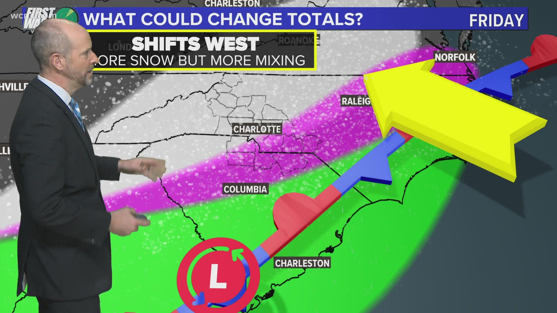
That rain first arrives alongside a cold front, which will push southward into the Carolinas ushing in colder air from the north. The cold front stalls somewhere near the Carolinas coast. Depending on where this cold front stalls, it should clear a path for a low-pressure system, currently near Texas Wednesday, to push new precipitation into the Carolinas. The combination of the colder air, and new moisture, is expected to yield the wintry precipitation chances Friday.
Ice threat is low this time
The positioning of the systems should allow the main ice threat to say out of the Charlotte area.
"I think the air is plenty cold enough that this is going to be snow or sleet," Panovich said. "Freezing rain will be down closer to the coast."
Panovich said areas east of Charlotte, including Wilmington, will be at greater risk of freezing rain.
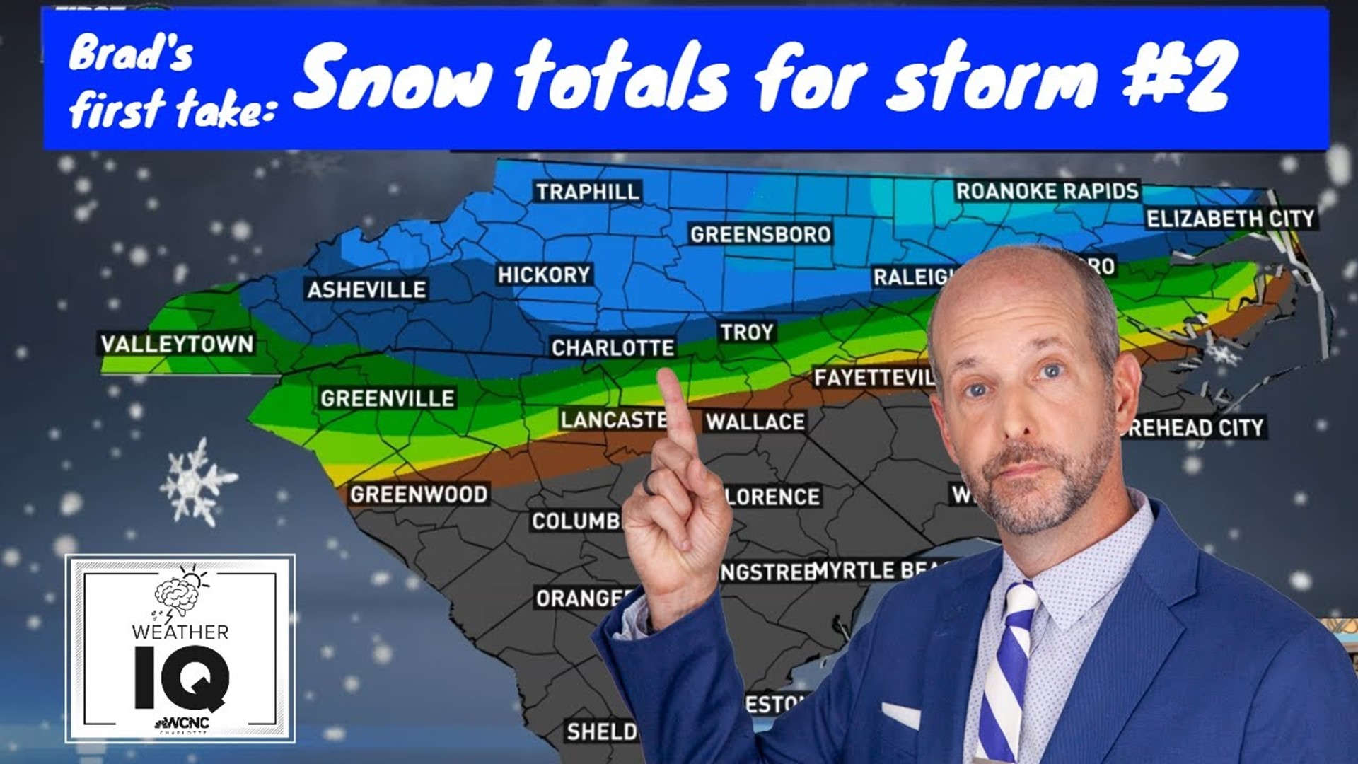
Brad's preliminary snow and ice accumulation forecast
On Wednesday morning's Weather IQ video, Panovich released his preliminary first look at snow and ice totals with this new storm.
For Charlotte, Panovich expects between one and three inches of snow Charlotte. The highest amounts will be further east of Uptown Charlotte.
Snowfall totals could fall short if temperatures manage to stay just above freezing long enough to usher in more hours of rain.

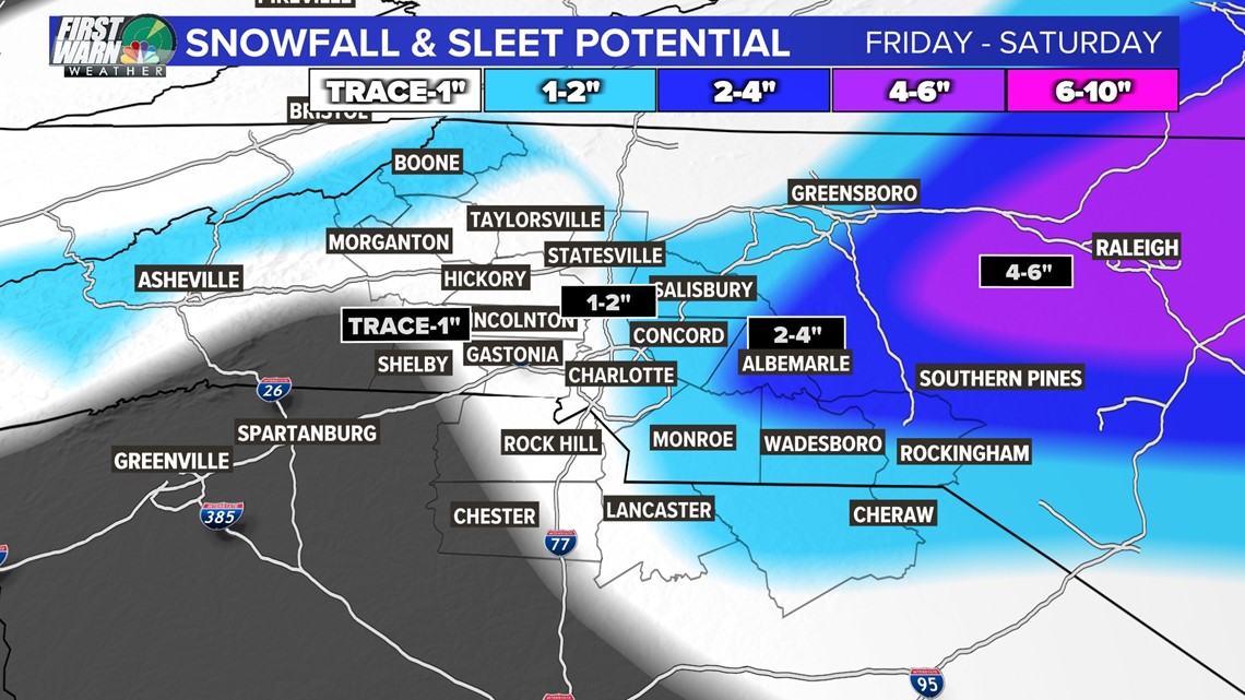
Some precipitation mixing could usher some sleet into counties south and east of Charlotte, including Chester, Chesterfield, Lancaster, Union, Richland, and Montgomery counties. Those communities could see a light coating of ice.

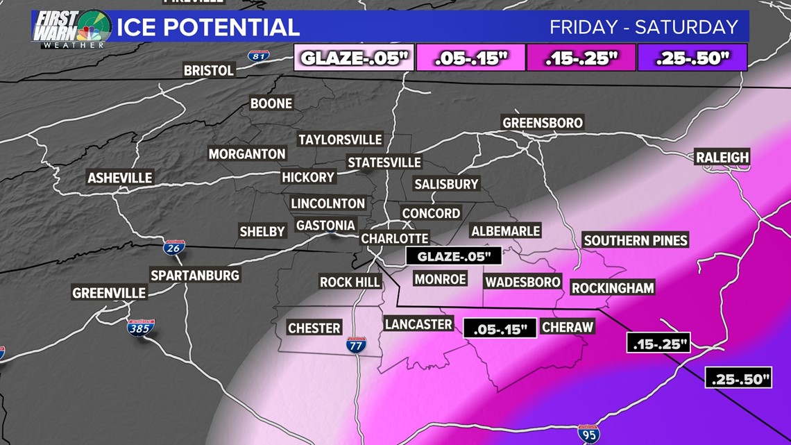
Compared to the storm this past Sunday, forecast ice totals around the broader Charlotte area are smaller than Sunday. Over the past 12 hours, the track has shifted slightly eastward, which could lower totals locally even more.
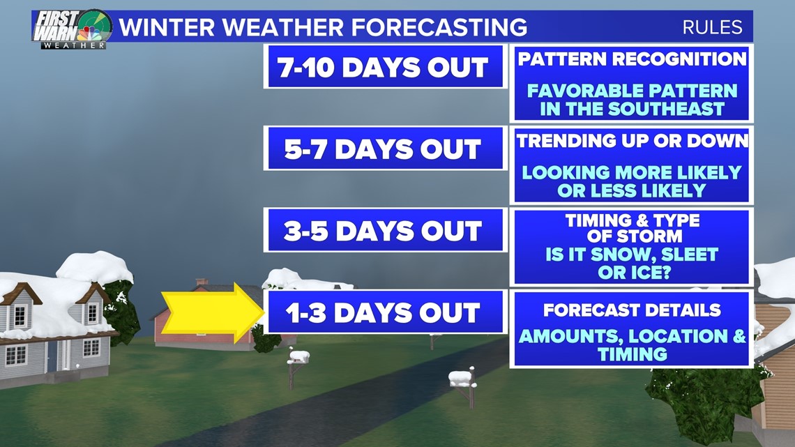
Wednesday moved us into the "1-3 days out" ahead of a winter storm, which according to Panovich's own winter weather forecasting rules, provides enough confidence to begin forecasting amounts, locations, and timing.