
CHARLOTTE, N.C. — Power crews are working to restore power to the thousands of Carolinians without power on Saturday after Ian impacted both North Carolina and South Carolina.
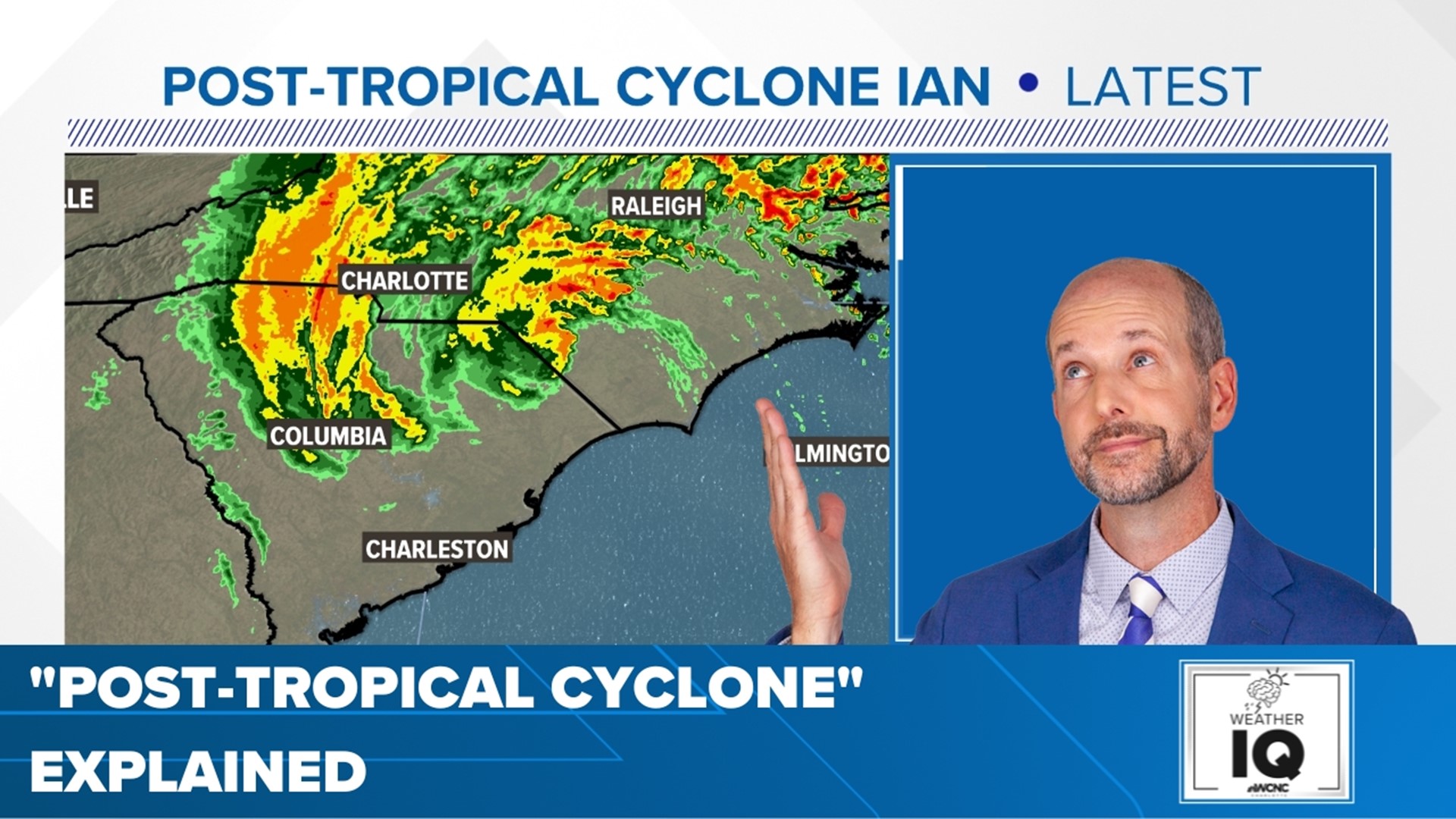
The eye of Hurricane Ian made landfall on the South Carolina coast near Georgetown just after 2 p.m. Friday. By 5 p.m., Ian was downgraded to a post-tropical cyclone.
RELATED: What is a 'post-tropical cyclone?'
By 7 p.m., the worst of the storm had exited the Charlotte area as heavier rains continued through the higher elevations of western North Carolina foothills and mountains.
The Charlotte area saw wind gusts up to 46 mph Friday afternoon, this gust was recorded at the Charlotte Douglas International Airport. Strong winds continued through the evening, too. On Friday, Charlotte saw rainfall totals of roughly 2.44 inches, with the highest rainfall totals being reported in Gastonia at 2.84 inches.
Thousands of Duke Energy customers were without power in the Charlotte area as of Saturday morning, according to Duke Energy's outage map. WCNC Charlotte will continue to monitor outages and when customers can expect power to be restored.
Conditions along the coast
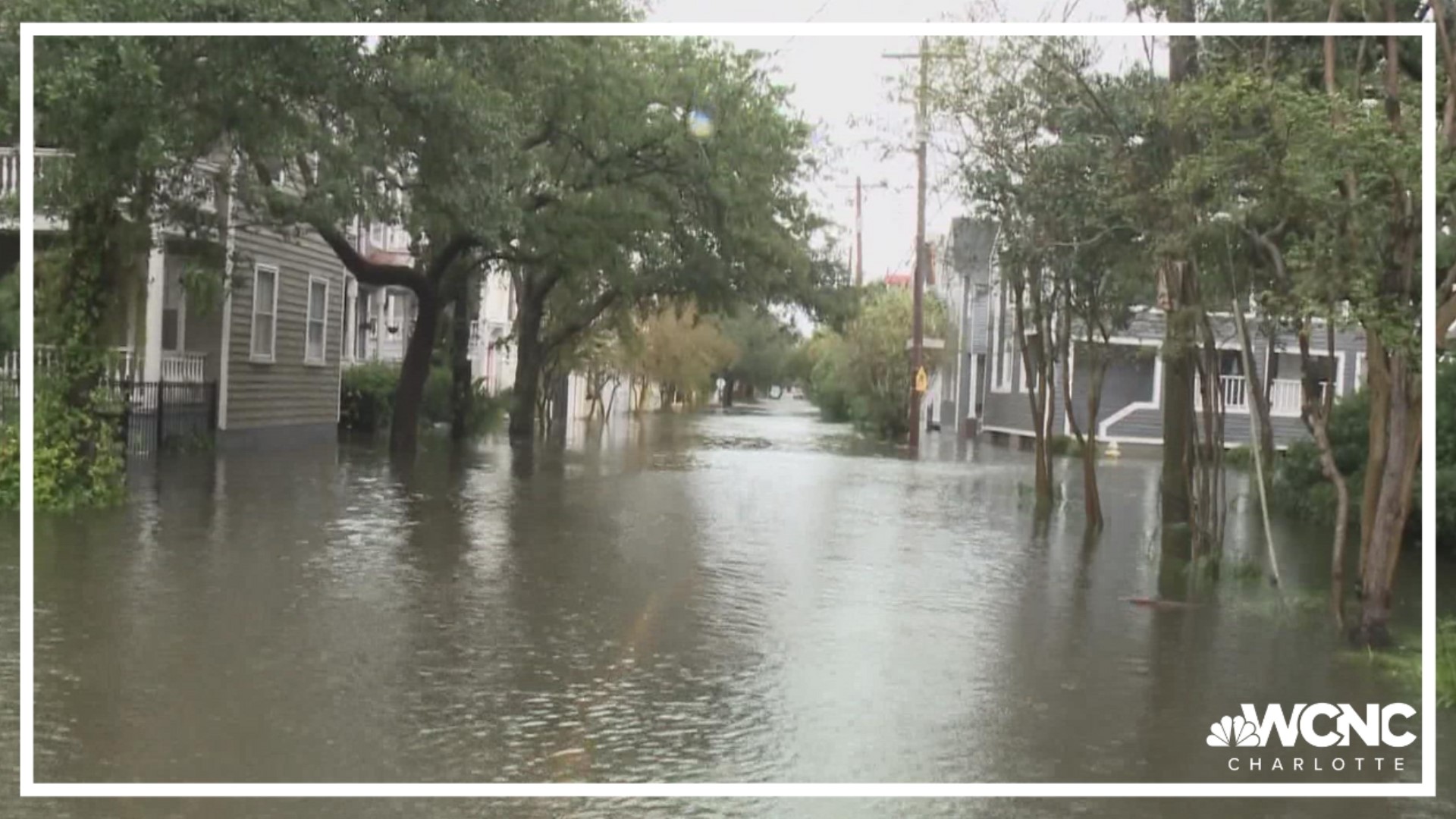
Charleston was already starting to flood early Friday, with WCNC Charlotte's Vanessa Ruffes reporting knee-high floodwaters near the Battery at Charleston Harbor. Low-lying areas were underwater, with officials encouraging people to seek higher ground due to the flooding risk.
WCNC Charlotte chief meteorologist Brad Panovich said Charleston reported wind gusts as high as 56 mph as Ian moved closer to landfall.
Conditions deteriorated quickly along the South Carolina coast Friday morning.
Friday was a Weather Aware Day. Any time a person sees the Weather Aware label on the forecast or on social media, they know it's about their personal safety, their family's safety and protecting their property.
Beyond the typical severe weather, there are dangerous heat waves, record-breaking cold snaps or even hazardous winds that could impact people's safety. Those instances would cause WCNC Charlotte's Weather Team to tell everyone they should be Weather Aware.
Saturday in the Carolinas
The storm will move through the Piedmont fairly quickly Friday night, which is good news for any flooding. The mountains and foothills of North Carolina will be at a greater risk of flooding as the rain lingers through Saturday morning.
"Saturday afternoon is looking much better," Panovich said referencing some initial forecast trends from earlier in the week that kept the storm around longer.
What you can expect from WCNC Charlotte?
Brad Panovich and the WCNC Charlotte weather team will provide updates on Ian throughout the weekend.
Receive severe weather alerts straight to your phone by downloading the WCNC Charlotte app, where you can also send the team photos and videos of the storm as it is safe to do so.
Brad and the team will have expanded, live-streaming coverage of the storm, which you can watch for free on the WCNC Charlotte phone app, the WCNC+ apps for Roku and Amazon Fire, YouTube, and on WCNC.com.