
CHARLOTTE, N.C. —
Idalia update: Downgraded to a tropical storm
Tropical Storm Idalia is racing over the Carolinas on a path to the northeast, dumping heavy rain and causing widespread flooding along the Carolina coast.
At 11 a.m. EDT Thursday, Idalia began moving eastward off the North Carolina coast with strong winds and storm surge in the eastern part of the state. The storm's location was about 85 miles southeast of Cape Lookout, according to the National Hurricane Center. Idalia has sustained winds of 60 mph and created rough surf from Charleston to Kill Devil Hills Thursday morning.
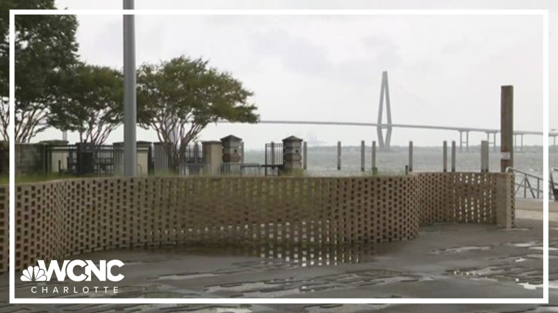
WCNC Charlotte's Richard DeVayne was in Charleston, where officials said the fifth-highest storm surge was recorded during Idalia. Fortunately, the floodwaters were receding by 6 a.m. as the rain had mostly stopped with the storm pushing north. Forecaster Larry Sprinkle said Idalia will continue to bring rain to the Outer Banks throughout the day but should be completely out of North Carolina by Thursday afternoon.
There's a Flood Watch in effect for areas southeast of Charlotte until 8 p.m. Thursday.
Idalia made landfall along Florida's Big Bend area around 7:45 a.m. Wednesday as a strong Category 3 hurricane. Idalia had estimated wind speeds of around 125 mph, according to the National Hurricane Center. Idalia's landfall happened at Keaton Beach in Taylor County, which is near the city of Perry.
The storm made history, becoming just the third major hurricane (Category 3 or higher) storm to make landfall along the Big Bend.
Water levels along the Big Bend of Florida reached up around 10 feet but the peak surge has yet to be disclosed. This storm started moving faster overnight which helped give it less time to rapidly intensify, but it was enough. Idalia peaked to a low-end Category 4 hurricane less than two hours before landfall.
"The faster the storms move, the slower it takes for the winds to calm down," WCNC Charlotte chief meteorologist Brad Panovich said in a weather vlog. "What happens is, as storms go over land, they weaken. But if it's flying, there's not enough time for that wind to calm down. So you can bring really strong, hurricane-force winds well inland."

Idalia is the second major hurricane in the Atlantic Basin and the first to make landfall in the United States this season.
HISTORY OF IDALIA: Idalia officially became a hurricane at 5 a.m. Tuesday and quickly strengthened to Category 2 status by 5 p.m. As the storm moved north over warm waters in the Gulf of Mexico, it rapidly intensified to Category 4 Wednesday morning before coming ashore as a Category 3 near Keaton Beach, Florida.
South Carolina and North Carolina coastal impacts
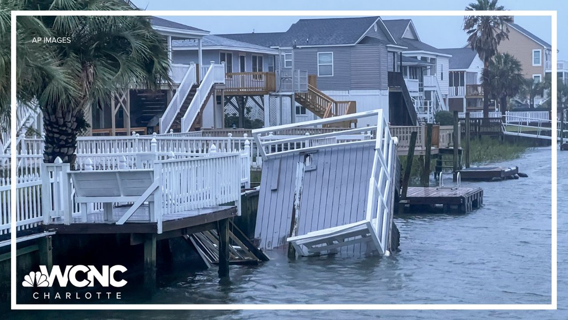
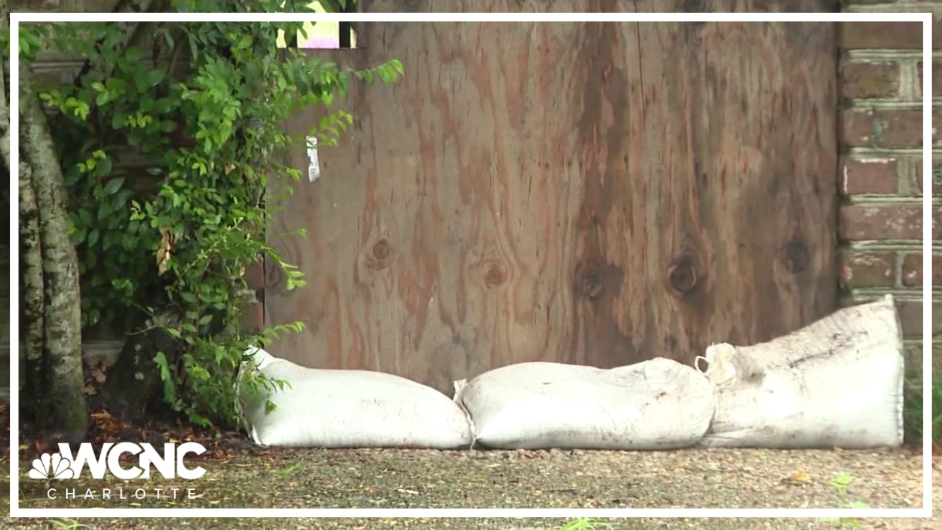
Storm surge was one of the main impacts for communities along coastline of South Carolina and North Carolina.
North Carolina Gov. Roy Cooper, who declared a statewide emergency earlier this week as Idalia approached, warned residents in coastal and eastern inland counties to prepare for heavy rainfall and localized flooding, and urged them to stay off roads covered by water.
“Always we want to keep an eye out on flash flooding and potentially riverine flooding,” Cooper told reporters at the state’s emergency operations center. “This storm is moving faster than people had anticipated. That means we’re going to get some stronger winds than we thought we were going to get, but maybe less rain.”
South Carolina Gov. Henry McMaster issued no evacuations orders and isn't planning to close state offices as storm Idalia is forecast to move along the state’s coast overnight.
“This is not as bad as some we’ve seen,” said McMaster, who has ordered at least three coastal evacuations since taking office in 2017. The state is ready to respond if the storm is worse than anticipated, McMaster said, and he encouraged people to stay home.
Hilton Head Island Emergency Manager Tom Dunn said as much as 6 inches (15 centimeters) of rain combined with a potential storm surge of 4 feet (1.2 meters) could submerge parts of the island.
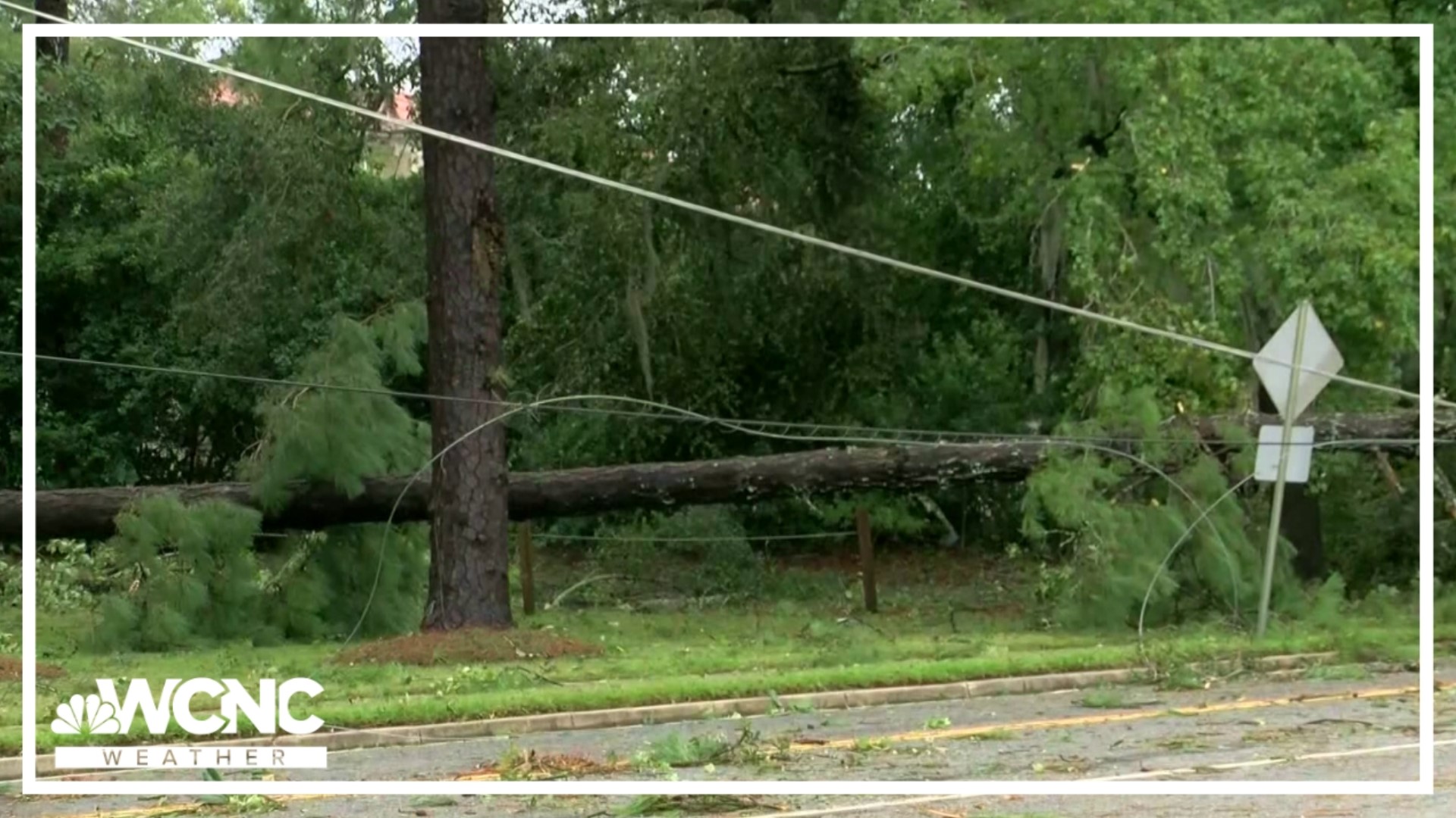
Idalia spawned a tornado that briefly touched down in the Charleston, South Carolina, suburb of Goose Creek, the National Weather Service said. The winds sent a car flying and flipped it over, according to authorities and eyewitness video. Two people received minor injuries.
President Joe Biden called the governors of Florida, Georgia, North Carolina and South Carolina on Wednesday and told them their states had his administration’s full support, the White House said.
The American Red Cross North Carolina Region said it is working with its partners in South Carolina to deploy teams to the hardest hit areas of the Carolinas including Myrtle Beach and Charleston. The North Carolina team told WCNC Charlotte it has sent at least 20 people to Florida and Georgia for assistance. Their efforts will be focused on assessing damage, feeding people in need, and distributing supplies to help support clean up.
"We have people who are able to support disaster mental health and spiritual care to someone who's just been through a disaster like this," regional CEO of humanitarian services Allison Taylor added.
Hurricane Franklin -- which did not hit land -- is producing life-threatening surf and rip currents along the Southeast coast.
"The biggest threat though in the Carolinas is going to be the southern Pamlico Sound because we've got all this rain from this week, and from the rain from the storm trying to push out of the rivers, but water is being pushed in by the surge in the wind, so that water can't go anywhere," Panovich explained in his vlog. "So it spills over the banks, gets pushed into all those bays and canals and swamps and rivers, and it just overflows There's just nowhere for the water to go."
For the latest weather alerts, download the WCNC Charlotte mobile app and enable push notifications.
Panovich warned that some of the inner coastal areas could see some significant water because of the astronomical high tide, so people will need to keep their guard up. As a reminder, forecasts can change quickly, so please keep checking back for updates from the WCNC Charlotte Weather Team as the forecast pivots.
"This is going to be a 12-hour window of maybe 3 or 4 [p.m.] to 3 or 4 [a.m.] tomorrow for Charlotte, and then it's out of here," Panovich outlined in his vlog. Rain will not be a major issue for Charlotte. All rain should be out of the area by sunset Thursday morning.
Winds may also be a concern along the rain bands. While the wind speeds themselves won't be too gusty nearly Charlotte -- possibly ranging between 30 to 40 mph -- the area received a lot of rain recently.
"Remember, the ground can get saturated already is in some areas, and just takes 30 mph wind to bring down a tree in some of those situations where you just have some wet soils," Panovich noted.
The coast is where Idalia should produce the strongest winds overall. Idalia will move out to sea Thursday but it isn't fully gone. This will leave a great weekend but for the Carolinas, but will create dangerous swimming conditions for beach goers.
This hurricane is officially the 131st documented category 4 hurricane but not the strongest. Hurricane Franklin currently holds that title for the season but will not be retired like Idalia likely will.
Contact Brad Panovich at bpanovich@wcnc.com or follow him on Facebook, Twitter and Instagram.
Contact KJ Jacobs at kjacobs3@wcnc.com and follow him on Facebook, Twitter and Instagram.
Contact Chris Mulcahy at cmulcahy@wcnc.com and follow him on Facebook, Twitter, Instagram and TikTok.
Contact Brittany Van Voorhees at bvanvoorhe@wcnc.com and follow her on Facebook, Twitter and Instagram.
Contact Larry Sprinkle at lsprinkle@wcnc.com and follow him on Facebook, Twitter and Instagram.
WCNC Charlotte’s Weather IQ YouTube channel gives detailed explainers from the WCNC Charlotte meteorologists to help you learn and understand weather, climate and science. Watch previous stories where you can raise your Weather IQ in the YouTube playlist below and subscribe to get updated when new videos are uploaded.