

It's one of the most frequently asked questions of meteorologists in the northern hemisphere: “Why do tropical cyclones move east-to-west in the Atlantic Basin when most other storm systems move west-to-east across the United States?
A misconception about hurricanes and tropical storms is that the winds in the storm move the storm across the ocean. However, a hurricane with 200 mph winds can barely move while a tropical storm with 40 mph winds can race across the Atlantic Ocean.
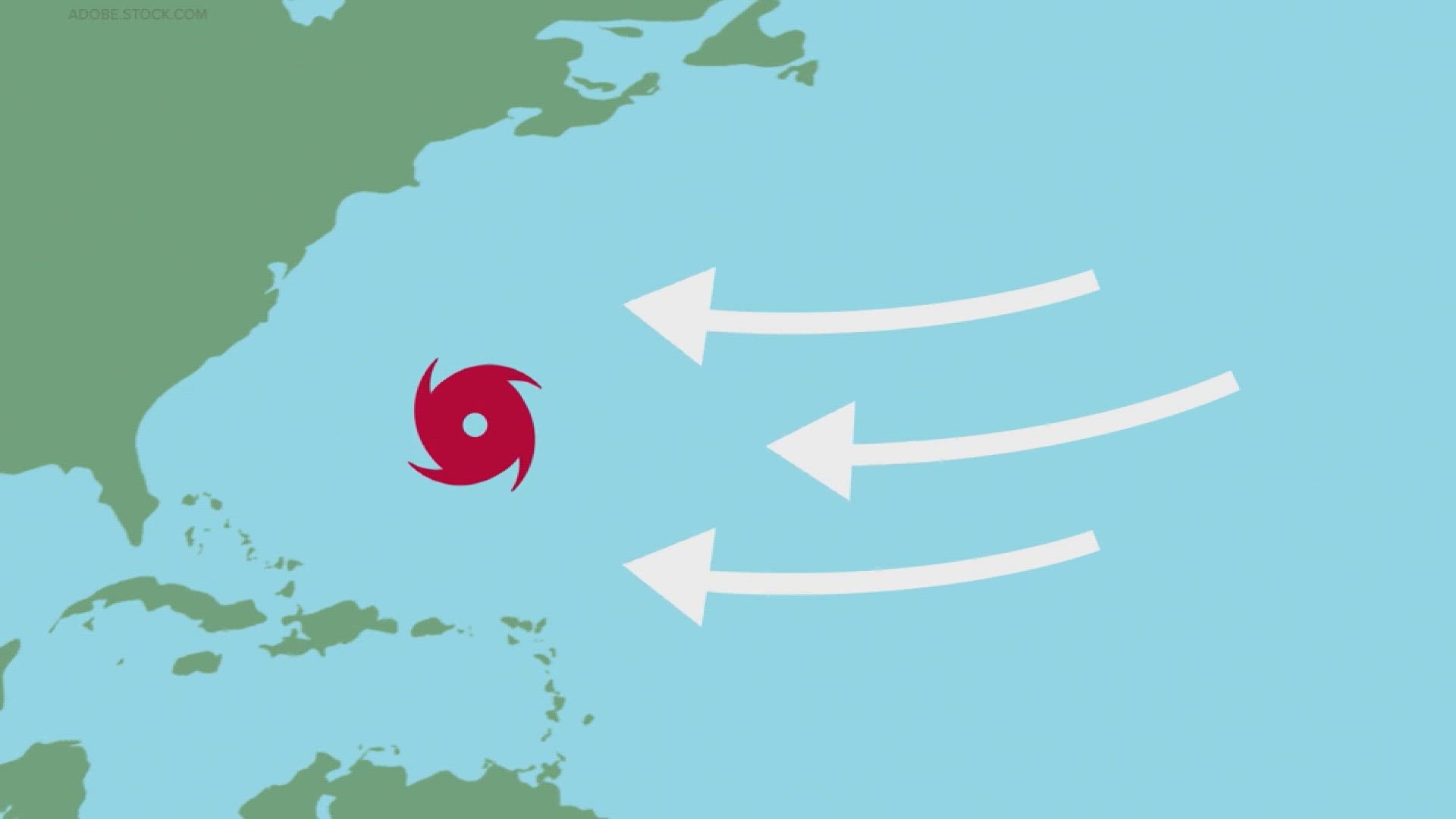
The movement of tropical cyclones is controlled by steering currents, or steering winds. These winds exert a strong influence on the direction of weather disturbances embedded within the steering current itself.
Hurricanes and tropical storms need something to pick them up and tell them where to go. They need some kind of atmospheric movement much like a puppeteer and their puppet.
Without these currents, storms would not move. A good example of this stationary movement is Hurricane Dorian from 2019. That storm sat over the Bahamas for days due to weak steering currents in the western Atlantic.
This is different from non-tropical weather systems like fronts, troughs of low pressure, and ridges of high pressure. These generally move from the west to the east across the United States. The difference in direction is because these weather patterns have different steering currents.
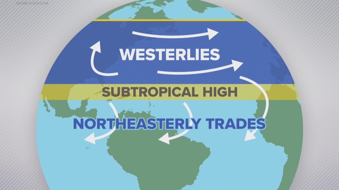
The boundary that separates these varying steering winds is called the subtropical ridge of high pressure, which is located around 30 degrees north latitude. This subtropical ridge does move over time. It is farther south in the winter and farther north in the summer.

For the latest weather alerts, download the WCNC Charlotte mobile app and enable push notifications.
South of the subtropical ridge, the trade winds blow east to west. Whereas north of the ridge, the westerlies blow west to east.
After a tropical storm is carried far enough north by the steering currents, the westerlies are frequently responsible for curving tropical cyclones back out to sea.
Unfortunately for weather forecasters, these steering currents can easily bust a forecast. The constant shifting of atmospheric weather patterns keeps things fluid.
Dorian is, again, a great example of this phenomenon. The forecast track was extremely erratic for days because the flows were weak and frequently changing.
This is one of the reasons why meteorologists track every small change in a storm, including the shifting of a storm's eye (the center of circulation) or rapid intensification, which can quickly strengthen the storm.
The smallest of changes can have a huge impact on where the storm goes and how strong it is. At the end of the day, its steering currents that move the weather.
Contact Brittany Van Voorhees at bvanvoorhe@wcnc.com and follow her on Facebook, X and Instagram.
WCNC Charlotte’s Weather IQ YouTube channel gives detailed explainers from the WCNC Charlotte meteorologists to help you learn and understand weather, climate and science. Watch previous stories where you can raise your Weather IQ in the YouTube playlist below and subscribe to get updated when new videos are uploaded.