
CHARLOTTE, N.C. — A strong storm system moving through the Carolinas produced a grand total of 14 tornado reports, 160 wind reports and 25 large hail reports in the last 24 hours across the United States. When it reached Charlotte early Wednesday morning, it brought periods of heavy rain, lightning and thunder - but Charlotte dodged any significant damage from the storm.
The storms came ahead of a cold front, which is pushing through the region Wednesday and is forecast to bring some spotty rain showers and even an isolated thunderstorm.
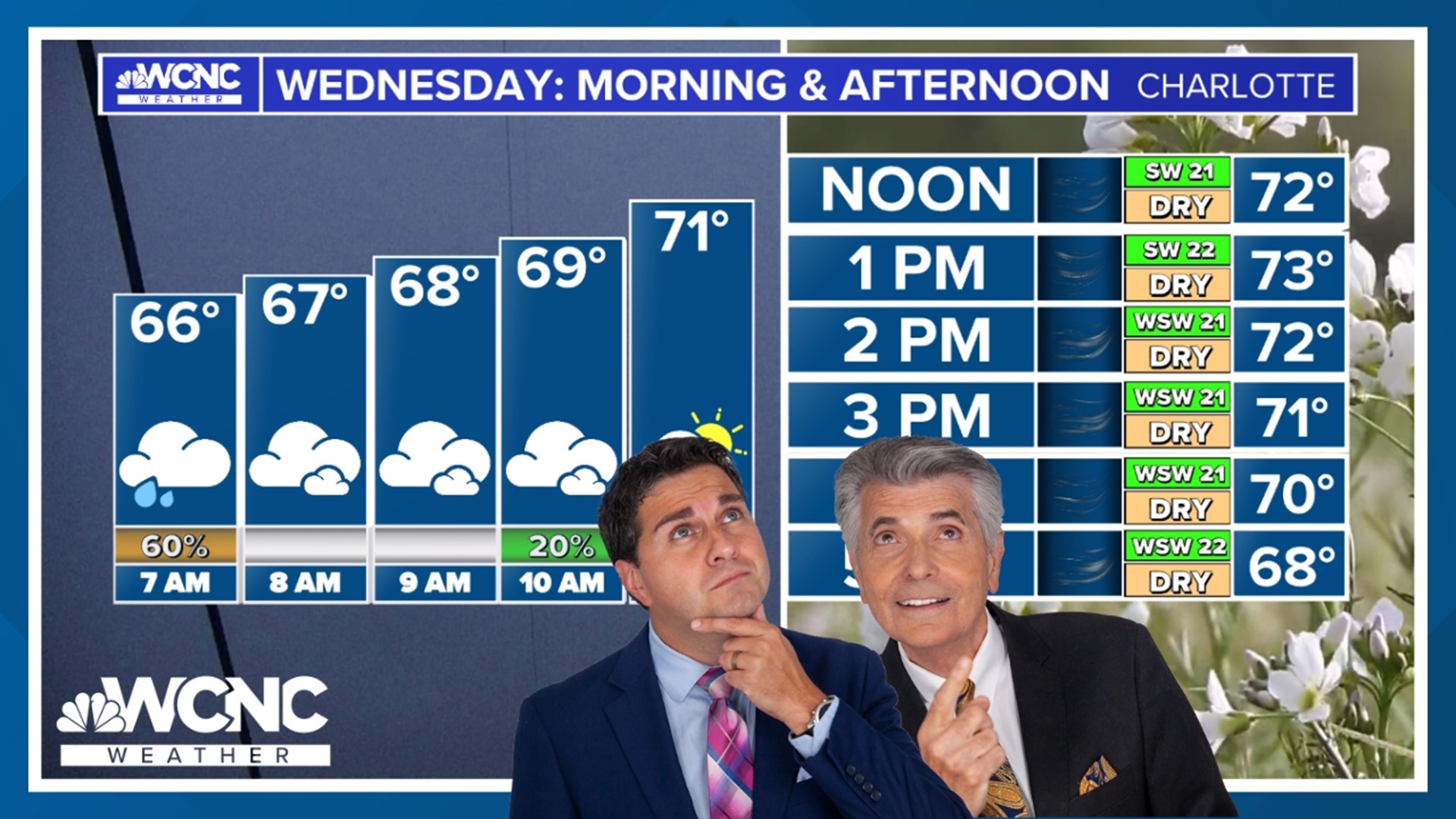
With the storms now gone, sunny and windy weather remains. As the cold front passes through the region Wednesday afternoon, a high temperature of 70 degrees will give way to cooler temperatures before sunset. Winds could gust over 30 mph on and off throughout the day.
The storm system is ushering in one more cold snap, with the WCNC Charlotte weather team forecasting:
- Tonight: Lows temperatures in the low-to-mid 40s
- Tomorrow: High temperatures will likely stay in the 50s. For comparison, Sunday's high temperature was 83.
- Friday through Sunday morning: The day begins at sunrise with temperatures in the 30s
- Friday and Saturday: Afternoon high temperatures will be in the lower 60s
Storm threats
Some storms were expected to be strong enough to produce severe, damaging winds. While the tornado risk was low, WCNC Charlotte Chief Meteorologist Brad Panovich said you can't rule them out entirely.
"Definitely charge up your phone and have the volume turned up tonight because we could have some overnight and early morning storms that could pose some issues," Panovich said ahead of the storms.
The threat of storms came at a time when most people were sleeping. To keep you safe and Weather Aware, the WCNC Charlotte Weather Team suggested having multiple ways to receive severe weather warnings. Devices included NOAA weather radios, which act like smoke detectors by sounding an audible alarm if and when a severe storm approaches your location, and the WCNC Charlotte's mobile app.
For the latest weather alerts, download the WCNC Charlotte mobile app and enable push notifications.
RAISE YOUR WEATHER IQ: How to receive severe weather warnings
Storm damage elsewhere
This same line of storms produced severe weather west of the Carolinas on Monday and Tuesday. The storm system prompted storm warnings in locations such as Oklahoma on Monday. The line pushes east through Tennessee and Georgia Tuesday before moving into North Carolina and South Carolina during those predawn hours on Wednesday.
In Kentucky and Indiana, tornadoes are being blamed for storm damage.
Photos of storm damage from Kentucky and Indiana:
Hours ahead of the storms arriving in the Carolinas, it produced a likely tornado outside Atlanta.
The likely tornado in Conyers, Georgia toppled trees into homes and produced numerous power outages.
WCNC Charlotte’s Weather IQ YouTube channel gives detailed explainers from the WCNC Charlotte weather meteorologists to help you learn and understand weather, climate and science. Watch previous stories where you can raise your Weather IQ in the YouTube playlist below and subscribe to get updated when new videos are uploaded.