
CHARLOTTE, N.C. — Winter begins on Dec. 21 but the weather is already bringing cold temperatures, cloudy skies to parts of the Carolinas. While this weather setup is not unique to the Carolinas, it's caused by a weather phenomenon that heavily influences weather in Charlotte and beyond.
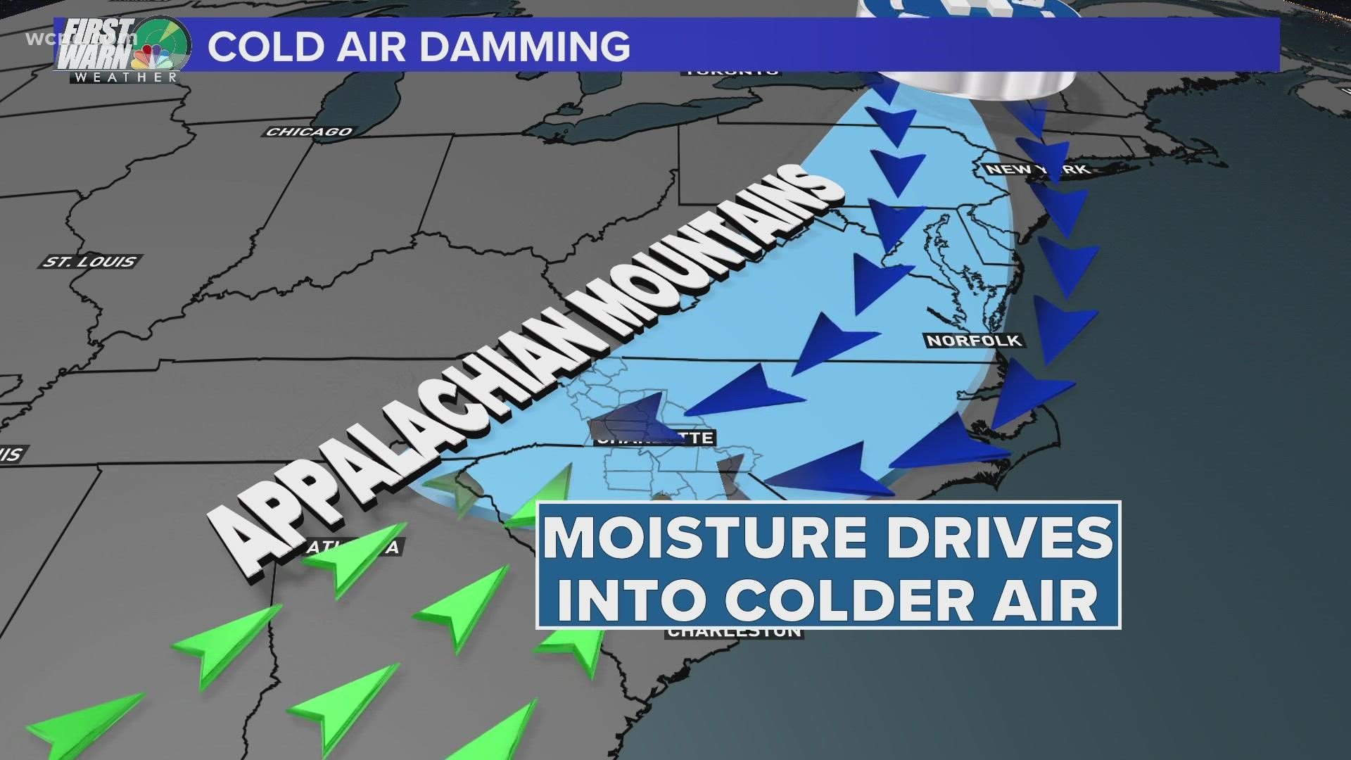
Cold Air Damming, sometimes called the CAD or the wedge, traps overcast, cold and damp conditions against the Appalachian Mountains. Those conditions can persist for days and keep places like Charlotte dark and gloomy.
Here's how the wedge forms:
High pressure positioned north of the Carolinas directs dense, cold air southward into the mid-Atlantic and parts of the southeast. Meanwhile, moist and warmer air moves into the region from the south.
WCNC Charlotte chief meteorologist Brad Panovich showed this weather setup in a 2018 tweet below:
What makes cold air damming unique to the Carolinas is the Appalachian Mountains. The mountains' elevation and topography, combined with the overall north/south orientation, create a natural barrier.
The mountainous boundary dams the air into a wedge that protrudes into western North Carolina and upstate South Carolina.
With this setup in place, the weather between the western Carolinas and eastern Carolinas can range greatly: with cooler, rainy, and cloudier conditions in the east, and warmer, clearer, sunnier conditions to the east.
In this 2015 tweet, western temperatures were in the 40s and 50s while coastal temperatures flirted with 70 degrees.
The impacts from the wedge are not purely limited to surface temperatures between the east and the west.
The wedge is made of a cold, dense air mass, which is heavy. This causes it to settle down toward the Earth's surface. This is similar to how water and oil separate in a glass: water sinks to the bottom as oil rises to the top.
As the cold air sinks, a surge of warm, moist air rises into the upper levels of the atmosphere. This is called an inversion. An inversion is a reversal of normal temperature behavior. Typically, it is warmer on the ground than in the sky but not with the wedge.
In summary:
When looking at the profile of the atmosphere column vertically, this weather event results in a shallow layer of cold air being trapped at the surface under a layer of clouds blocking sunlight. The mountains act as a dam and restrict the flow of the cold air as it spills in from the north.
It's often nicknamed the "wedge" because this action causes colder air to become entrenched, or wedged, against the mountains. The cool pool of air can only drift southward.
A few outcomes occur from the event. Temperatures at the surface can be dramatically cooler. Also, light rain and overcast conditions can impact the region under the wedge. Cities like Charlotte could be stuck in these weather conditions for hours or even days.
Cold air damming events can be challenging for forecast models when it comes to intensity and duration.
When does it end?
Typically, a cold front will move through the region. A strong enough cold front would be strong enough to move out the cloudy, cold, damp conditions. Once the wedge is cleared, other weather conditions can return.
Contact KJ Jacobs at kjacobs3@wcnc.com and follow him on Facebook, Twitter and Instagram.